Southeast Raleigh in Wake County, North Carolina — The American South (South Atlantic)
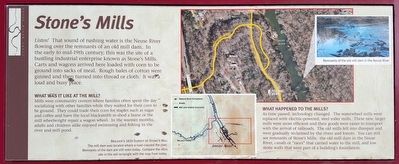
Stone's Mills
What Was It Like At The Mill?
Mills were community centers where families often spent the day socializing with other families while they waited for their corn to be ground. They could trade their corn for staples such as sugar and coffee and have the local blacksmith re-shod a horse or the mill wheelwright repair a wagon wheel. In the warmer months, adults and children alike enjoyed swimming and fishing in the river and mill pond.
What Happened To The Mills?
As time passed, technology changed. The waterwheel mills were replaced with electric-powered, steel roller mills. These new, larger mills were more efficient and their goods were easier to transport with the arrival of railroads. The old mills fell into disrepair and were gradually reclaimed by the rivers and forests. You can still see remnants of Stone's Mills: the old mill dam in the Neuse River, canals or "races" that carried water to the mill, and low stone walls that were part of a building's foundation.
(caption)
Brazier's 1820 Survey Of Stone's Mill
The mill dam was located where a road crossed the river. Remnants of the dam are still seen today. Compare the 1820 site in the red rectangle with the map from today.
Topics. This historical marker is listed in these topic lists: Industry & Commerce • Waterways & Vessels. A significant historical year for this entry is 1820.
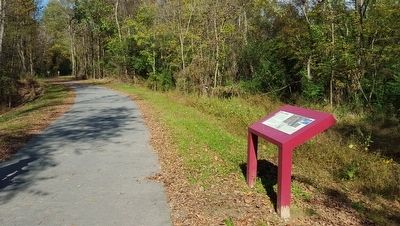
Location. 35° 44.95′ N, 78° 31.9′ W. Marker is in Raleigh, North Carolina, in Wake County. It is in Southeast Raleigh. Located on the Neuse River Trail. Touch for map. Marker is in this post office area: Raleigh NC 27610, United States of America. Touch for directions.
Other nearby markers. At least 8 other markers are within 3 miles of this marker, measured as the crow flies. Tenant House (approx. 2.7 miles away); The Pecan Grove (approx. 2.7 miles away); Carriage House (approx. 2.7 miles away); Farm House (approx. 2.7 miles away); Livestock Barn (approx. 2.7 miles away); Plank Kitchen (approx. 2.7 miles away); Cotton Gin House (approx. 2.8 miles away); In the Field (approx. 2.8 miles away). Touch for a list and map of all markers in Raleigh.
Credits. This page was last revised on February 16, 2023. It was originally submitted on October 31, 2015, by Bernard Fisher of Richmond, Virginia. This page has been viewed 368 times since then and 13 times this year. Photos: 1, 2. submitted on October 31, 2015, by Bernard Fisher of Richmond, Virginia.

