Waverly in Lafayette County, Missouri — The American Midwest (Upper Plains)
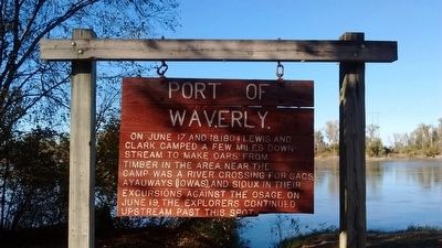
Port of Waverly
Topics and series. This historical marker is listed in this topic list: Exploration. In addition, it is included in the Lewis & Clark Expedition series list. A significant historical date for this entry is June 17, 1804.
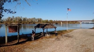
Location. 39° 12.799′ N, 93° 31.03′ W. Marker is in Waverly, Missouri, in Lafayette County. Marker is on Main Street when traveling north. The marker is located where Main Street dead ends into the Missouri River. Touch for map. Marker is in this post office area: Waverly MO 64096, United States of America. Touch for directions.
Other nearby markers. At least 8 other markers are within 12 miles of this marker, measured as the crow flies. The Lewis and Clark Expedition Across Missouri (here, next to this marker); Lewis and Clark (about 600 feet away, measured in a direct line); Gen. Joseph O. Shelby Park (approx. 0.3 miles away); Santa Fe Trail (approx. 9.4 miles away); Court House Bell (approx. 10 miles away); General James Shields (approx. 10.1 miles away); Trail of Death (approx. 10.6 miles away); a different marker also named General James Shields (approx. 11.9 miles away). Touch for a list and map of all markers in Waverly.
Credits. This page was last revised on June 16, 2016. It was originally submitted on November 7, 2015, by Tom Bosse of Jefferson City, Tennessee. This page has been viewed 395 times since then and 22 times this year. Photos: 1, 2, 3. submitted on November 7, 2015, by Tom Bosse of Jefferson City, Tennessee. • Bill Pfingsten was the editor who published this page.


