Limehill Battlefield / Joseph Elliott
April 14, 1782
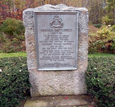
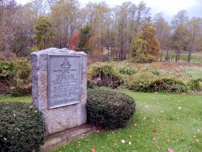
Limehill Battlefield
In attempting to rescue Mrs. Roswell Franklin and her four children who had been captured by Indians Sergeant Thomas Baldwin and his party met the enemy near this spot after four hours of fighting. Three of the children were rescued but Mrs. Franklin was killed. Sergeant Baldwins breastworks were located seventy rods northwest of this marker.
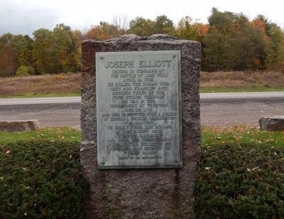
Joseph Elliott
Second in command at the battle of Lime Hill, April 14, 1782. He killed the Indian who shot Mrs. Franklin and rescued three of her four children. He was in the engagement at Trenton, December 25, 1776, and was presented a sword by General George Washington for bravery. He broke from the Indians at Bloody Rock, Wyoming Massacre, and swam the Susquehanna River with a bullet in his shoulder and escaped to Wilkesbarre. Erected by his descendants."
Erected 1926 by Pennsylvania Historic Commission and the Bradford County Historical Society.
Topics and series. This historical marker is listed in these topic lists: Native Americans • War, US Revolutionary. In addition, it is included in the Pennsylvania Historical and Museum Commission series list. A significant historical date for this entry is April 14, 1782.
Location. 41° 43.403′ N, 76° 17.454′ W. Marker is
Other nearby markers. At least 8 other markers are within 3 miles of this marker, measured as the crow flies. Lime Hill (here, next to this marker); The Battle of Lime Hill (here, next to this marker); Camptown Races (approx. 0.3 miles away); Azilum (approx. 0.6 miles away); Asylum (approx. 0.6 miles away); a different marker also named Asylum (approx. 1.4 miles away); Warriors Path (approx. 2.4 miles away); Landscapes of Conservation (approx. 2.4 miles away). Touch for a list and map of all markers in Wyalusing.
Credits. This page was last revised on June 16, 2016. It was originally submitted on November 11, 2015, by Don Morfe of Baltimore, Maryland. This page has been viewed 538 times since then and 32 times this year. Last updated on November 11, 2015, by Don Morfe of Baltimore, Maryland. Photos: 1, 2, 3. submitted on November 11, 2015, by Don Morfe of Baltimore, Maryland. • Bill Pfingsten was the editor who published this page.


