Fort Bridger in Uinta County, Wyoming — The American West (Mountains)
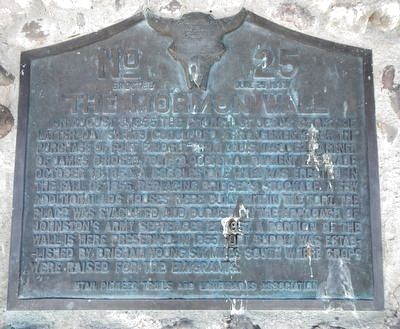
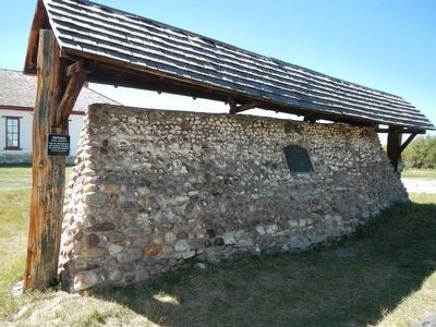
The Mormon Wall
Erected 1933 by Utah Pioneer Trails and Landmarks Association. (Marker Number 25.)
Topics and series. This historical marker is listed in these topic lists: Forts and Castles • Roads & Vehicles. In addition, it is included in the Utah Pioneer Trails and Landmarks Association series list. A significant historical date for this entry is September 27, 1857.
Location. 41° 19.08′ N, 110° 23.59′ W. Marker is in Fort Bridger, Wyoming, in Uinta County. Marker is on Business U.S. 80 near Main Street. Touch for map. Marker is in this post office area: Fort Bridger WY 82933, United States of America. Touch for directions.
Other nearby markers. At least 8 other markers are within walking distance of this marker. Post Commissary (within shouting distance of this marker); Old Guardhouse (within shouting distance of this marker); Women at the Trading Post (within shouting distance of this marker); Mormon Occupation (within shouting distance of this marker); Fort Bridger: A Trading Post (within shouting distance of this marker); Digging Up the Past (within shouting distance of this marker); Infantry Barracks (Museum) (within shouting distance of this marker); The Road to Zion (within shouting distance of this marker). Touch for a list and map of all markers in Fort Bridger.
More about this marker. This marker is located on the grounds of Fort Bridger Historic Site. Obtain a map at the entrance or museum.
Also see . . . When the United States Went to War Against the Mormons -. It sounds outlandish now, but the United States went to war with Mormons in the late 1850s. United States troops descended on the Utah Territory in 1857 due to growing concerns about actions carried out by the religious group and worries of sedition. (Submitted on November 15, 2015, by Barry Swackhamer of Brentwood, California.)
Additional keywords. 'The Mormon War'
Credits. This page was last revised on June 16, 2016. It was originally submitted on November 15, 2015, by Barry Swackhamer of Brentwood, California. This page has been viewed 423 times since then and 13 times this year. Photos: 1, 2, 3. submitted on November 15, 2015, by Barry Swackhamer of Brentwood, California.


