Gardnerville in Douglas County, Nevada — The American Mountains (Southwest)
Hiram Mott
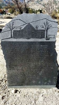
Inscription.
Buried here are Hiram Mott and family, emigrants from Canada. Isreal Mott, son of Hiram built this house a few yards east of the spot in July 1852. Eliza his wife was the first white women settler in Nevada. Their child Louisa was the first white child born in Nevada in this building. Nevada’s first school 1854, and first court held in this building in the Utah Territory or Carson Valley. Pioneers, ranchers, millers and first settlers.
Men and women who plant civilization in the desert who organize emigrants into communities and throw around them the protection of the law should not be forgotten.
Erected by Roy Jones.
Topics. This historical marker is listed in this topic list: Cemeteries & Burial Sites. A significant historical month for this entry is July 1852.
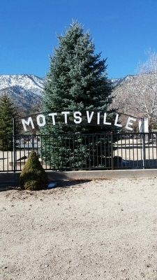
Location. 38° 55.921′ N, 119° 50.326′ W. Marker is in Gardnerville, Nevada, in Douglas County. Marker can be reached from Mottsville Cemetery Road north of Mottsville Lane/Waterloo Lane (Nevada Route 207). Marker is at the gravesite of Hiram Mott located at the Mottsville Cemetery. Touch for map. Marker is in this post office area: Gardnerville NV 89460, United States of America. Touch for directions.
Other nearby markers. At least 8 other markers are within 4 miles of this marker, measured as the crow flies. Mottsville (about 500 feet away, measured in a direct line); Sheridan (approx. 2.2 miles away); Kingsbury Grade (approx. 2.3 miles away); The Cary Mill (approx. 2.3 miles away); The Demise of Sam Brown (approx. 2.8 miles away); Walley's Hot Springs (approx. 3.4 miles away); Carson Trail - Hot Springs (approx. 3.4 miles away); Brockliss Road (approx. 3˝ miles away). Touch for a list and map of all markers in Gardnerville.
Credits. This page was last revised on June 16, 2016. It was originally submitted on November 15, 2015, by Syd Whittle of Mesa, Arizona. This page has been viewed 343 times since then and 16 times this year. Photos: 1, 2. submitted on November 15, 2015, by Syd Whittle of Mesa, Arizona.
Editor’s want-list for this marker. Wide area view of the marker and its surroundings. • Can you help?

