Haysi in Dickenson County, Virginia — The American South (Mid-Atlantic)
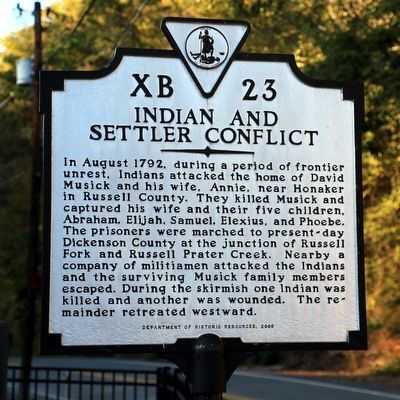
Indian and Settler Conflict
Erected 2000 by Department of Historic Resources. (Marker Number XB-23.)
Topics and series. This historical marker is listed in these topic lists: Native Americans • Settlements & Settlers. In addition, it is included in the Virginia Department of Historic Resources (DHR) series list. A significant historical month for this entry is August 1792.
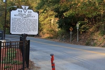
Location. 37° 12.396′ N, 82° 17.702′ W. Marker is in Haysi, Virginia, in Dickenson County. Marker is on Main Street (Virginia Route 63) west of Dickenson Highway (Virginia Route 80), on the left when traveling west. It is at the Haysi Town Park. Touch for map. Marker is in this post office area: Haysi VA 24256, United States of America. Touch for directions.
Other nearby markers. At least 8 other markers are within 6 miles of this marker , measured as the crow flies. Dr. Tivis C. & Emma Sutherland (a few steps from this marker); Colley’s Cabin (approx. 2.2 miles away); Buchanan County / Dickenson County (approx. 3.3 miles away); The Crooked Road (approx. 5.3 miles away); Mill Rock Point Overlook (approx. 5.3 miles away); Mill Rock Point (approx. 5.3 miles away); Formation Of The Breaks (approx. 5˝ miles away); The Name Breaks (approx. 5˝ miles away). Touch for a list and map of all markers in Haysi.
More about this marker. This marker replaces a marker with the same number but titled “Indian Outrage” erected here in Haysi before 1930 which read, “In 1792, Indians attacked the home of David Musick, near Honacker. Russell County, killing him and capturing his wife and five children. Near here the Indians were overtaken by pursuing settlers an the captives were retaken.”
Regarding Indian and Settler Conflict. Russell Prater Creek joins Russell Fork a couple of blocks east of this point, on Route 80 just a few feet south of its intersection with Route 63.
Also see . . . The David Musick Tragedy. Narrative prepared in 1956 by the late Judge Elihu J. Sutherland of the story told by David Musick’s great-great-grandson the Rev. Grover C. Musick. Excerpt: “Two of the boys, Abraham and Elijah, went early one morning for firewood with which to prepare breakfast. They were surprised by a party of Indians (not known how many), but were able to reach their home. The doors were barred, and the defense of the house began. David Musick had a flint-lock rifle. He found it would not fire, due to the fact his house had been burned previous to this, injuring the gun. Mrs. Musick touched fire to the gun, hoping to ignite the powder, but to no avail. Mr. Musick was shot through the thigh by an arrow from the bow of the Indians, and fainted from the loss of blood. The Indians broke into the home, killing and scalping him and making prisoners of his wife and children. They then plundered the house and ate what they found of prepared food, their hands gory with blood. While the Indians were attacking the house, a neighbor, who had come to the Musick home to borrow a plow, on seeing the Indians became so excited he ran with all speed possible. On reaching the yard of his home he fell dead. He must have had a weak heart.” (Submitted on November 18, 2015.)
Credits. This page was last revised on June 16, 2016. It was originally submitted on November 18, 2015, by J. J. Prats of Powell, Ohio. This page has been viewed 859 times since then and 96 times this year. Photos: 1, 2. submitted on November 18, 2015, by J. J. Prats of Powell, Ohio.

