Walker Township near Mifflintown in Juniata County, Pennsylvania — The American Northeast (Mid-Atlantic)
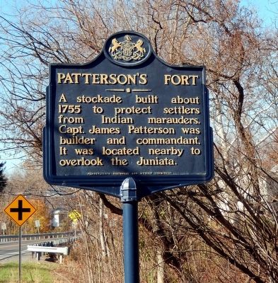
Patterson's Fort
Erected 1947 by Pennsylvania Historical & Museum Commission.
Topics and series. This memorial is listed in these topic lists: Forts and Castles • Native Americans • War, French and Indian. In addition, it is included in the Pennsylvania Historical and Museum Commission series list.
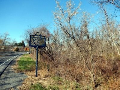
Location. 40° 32.154′ N, 77° 21.043′ W. Marker is near Mifflintown, Pennsylvania, in Juniata County. It is in Walker Township. Memorial is on William Penn Highway. Touch for map. Marker is at or near this postal address: 6837 William Penn Hwy, Mifflintown PA 17059, United States of America. Touch for directions.
Other nearby markers. At least 8 other markers are within 4 miles of this marker, measured as the crow flies. Col. William Patterson (about 400 feet away, measured in a direct line); First White Settlement in the Juniata Valley (about 500 feet away); Walker Township Veterans Memorial Honor Roll (about 500 feet away); Mexico (about 500 feet away); Fort Bigham (approx. 1.1 miles away); Tuscarora Path (approx. 1.2 miles away); Port Royal (approx. 2.1 miles away); In Grateful Acknowledgement (approx. 3.3 miles away). Touch for a list and map of all markers in Mifflintown.
Credits. This page was last revised on February 7, 2023. It was originally submitted on November 19, 2015, by Don Morfe of Baltimore, Maryland. This page has been viewed 557 times since then and 32 times this year. Photos: 1, 2. submitted on November 19, 2015, by Don Morfe of Baltimore, Maryland. • Bill Pfingsten was the editor who published this page.

