Near Montpelier in Bear Lake County, Idaho — The American West (Mountains)
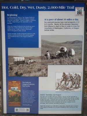
Hot, Cold, Dry, Wet, Dusty, 2,000-Mile Trail
Inscription.
Beginning in Independence, Missouri, the Oregon/California Trail passes through present-day Missouri, Kansas, Wyoming, and Idaho. it ends in Oregon, California or Utah - depending on the destination of the pioneers.
While the Oregon/California Trail sometimes was a single trail, in many places the wagons might spread out for 1/2 mile or more to avoid dust and to find gras for their animals.
At a pace of about 20 miles a day, the westward journey took most emigrants 4-1/2 to 5 months. Nearly all pioneers departed from Missouri in April or May in order to cross the mountains of Washington, California, or Oregon before winter.
Journey Hardships and Dangers
The route west was filled with many dangers. Disease was the main killer of trail travelers. An emigrant could die in only a few hours fro disease, or linger in misery for weeks. Sometimes they received a proper burial, but often the sick would be abandoned and left on the side of the trail. It is estimated that 10,000-30,000 pioneers died of small pox, flu, measles, mumps, cholera, drowning, other accidents, and Indian encounters.
Wagon ruts and graves are still visible in many places along the trail. Be sure to visit Georgetown Summit on US 30 north of Montpelier where the trail ruts are still visible.
The National Oregon/California Trail Center
Only 7.5 miles from here at the Intersection of US 30 and US 89, The National Oregon/California Trail Center features a "Living History" experience of the overland journey from Missouri to Clover Creek. Located on the original Clover Creek Encampment site of the pioneers, visitors have an opportunity to learn more about The Oregon/California Trail and to re-live pioneer life.
Erected by The National Oregon/California Trail Center.
Topics and series. This historical marker is listed in these topic lists: Roads & Vehicles • Settlements & Settlers. In addition, it is included in the California Trail, and the Oregon Trail series lists.
Location. 42° 14.151′ N, 111° 13.976′ W. Marker is near Montpelier, Idaho, in Bear Lake County. Marker is on U.S. 30 at milepost 441.7 near Hunters Lane, on the right when traveling west. Touch for map. Marker is in this post office area: Montpelier ID 83254, United States of America. Touch for directions.
Other nearby markers. At least 8 other markers are within 2 miles of this marker, measured as the crow flies. Idaho's Emigrant Trails (here, next to this marker); Big Hill... (here, next to this marker); One Continual Stream (here, next to this marker); Big Hill (here, next to this marker); a different marker also
named Big Hill (a few steps from this marker); The McAuley Cutoff (a few steps from this marker); McAuley's Road (within shouting distance of this marker); Smith's Trading Post (approx. 1.7 miles away). Touch for a list and map of all markers in Montpelier.
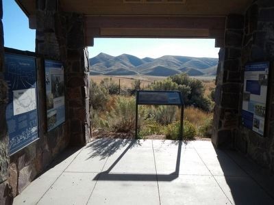
More about this marker. This marker is located in the stone kiosk.
Credits. This page was last revised on June 16, 2016. It was originally submitted on November 23, 2015, by Barry Swackhamer of Brentwood, California. This page has been viewed 562 times since then and 28 times this year. Photos: 1, 2. submitted on November 23, 2015, by Barry Swackhamer of Brentwood, California.

