Near Manassas in Prince William County, Virginia — The American South (Mid-Atlantic)
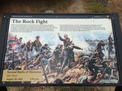
The Rock Fight
Second Battle of Manassas
— Day Three August 30, 1862 3:30 p.m. —
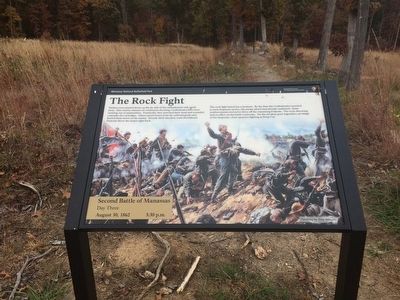
Yankees were pinned down on the far side of the embankment only yards away. After twenty minutes of continuous shooting, Confederates here were running out of ammunition. Frantically, they searched their dead and wounded comrades for cartridges. Others pried stones from the railroad grade and hurled them down on the enemy. Already shell-shocked, some bewildered Federals threw the stones right back.
The rock fight lasted but a moment. By the time the Confederates resorted to such desperate tactics, the enemy attack had already weakened. Soon reinforcements arrived to drive off the remaining Federals. The rock-throwing had no effect on the battle's outcome. Yet the incident grew legendary, an image of the desperate, close-quarters fighting at Deep Cut.
(caption)
Painting by Don Troiani
Erected by Manassas National Battlefield Park, National Park Service, U.S. Department of the Interior.
Topics. This historical marker is listed in these topic lists: Military • War, US Civil. A significant historical date for this entry is August 30, 1862.
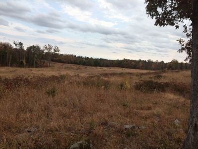
Location. 38° 49.285′ N, 77° 33.213′ W. Marker is near Manassas, Virginia, in Prince William County. Marker can be reached from Featherbed Road (County Route 622) half a mile north of Lee Highway (U.S. 29), on the left when traveling north. Marker is located along the 1-mile Deep Cut Loop Trail. This trail can be accessed from tour stop 7 of the Manassas National Battlefield Park Driving Tour. Touch for map. Marker is in this post office area: Gainesville VA 20155, United States of America. Touch for directions.
Other nearby markers. At least 8 other markers are within walking distance of this marker. 24th New York Infantry (a few steps from this marker); a different marker also named The Rock Fight (a few steps from this marker); Fourth Brigade (within shouting distance of this marker); 83rd Pennsylvania Infantry (within shouting distance of this marker); Groveton Monument (within shouting distance of this marker); Groveton Memorial (within shouting distance of this marker); 13th New York Infantry (within shouting distance of this marker); 15th Alabama Infantry (about 500 feet away, measured in a direct line). Touch for a list and map of all markers in Manassas.
Also see . . .
1. Manassas National Battlefield Park. National Park Service website entry (Submitted on November 30, 2015.)
2. Old Marker at this Location. This marker replaced an older one at this location also titled “The Rock Fight” (Submitted on November 30, 2015.)
Credits. This page was last revised on April 14, 2024. It was originally submitted on November 23, 2015, by Shane Oliver of Richmond, Virginia. This page has been viewed 872 times since then and 46 times this year. Photos: 1, 2, 3, 4. submitted on November 23, 2015, by Shane Oliver of Richmond, Virginia. • Bernard Fisher was the editor who published this page.


