Pennington Gap in Lee County, Virginia — The American South (Mid-Atlantic)
Pennington Gap
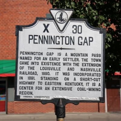
Erected 1941 by Virginia Conservation Commission. (Marker Number X-30.)
Topics and series. This historical marker is listed in these topic lists: Industry & Commerce • Railroads & Streetcars. In addition, it is included in the Virginia Department of Historic Resources (DHR) series list. A significant historical year for this entry is 1890.
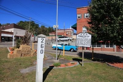
Location. 36° 45.508′ N, 83° 1.619′ W. Marker is in Pennington Gap, Virginia, in Lee County. Marker is at the intersection of Harrell Street and East Morgan Avenue (Alternate U.S. 58), on the left when traveling west on Harrell Street. It is in a small triangle-shaped park at the Morgan Avenue railroad crossing. Touch for map. Marker is at or near this postal address: 110 Harrell St, Pennington Gap VA 24277, United States of America. Touch for directions.
Other nearby markers. At least 8 other markers are within 9 miles of this marker, measured as the crow flies. Lee County Virginia / Kentucky (approx. 5˝ miles away); Long Hunters (approx. 6.1 miles away); Jonesville (approx. 7 miles away); Death of Boone's Son (approx. 7.4 miles away); Fanny Dickenson Scott Johnson (approx. 7.4 miles away); Doctor Still’s Birthplace (approx. 7.6 miles away); Jonesville Methodist Camp Ground (approx. 8.4 miles away); Civil War Routes (approx. 8.9 miles away in Kentucky).
Regarding Pennington Gap. The highway short-cut to Kentucky is today’s U.S. 421.

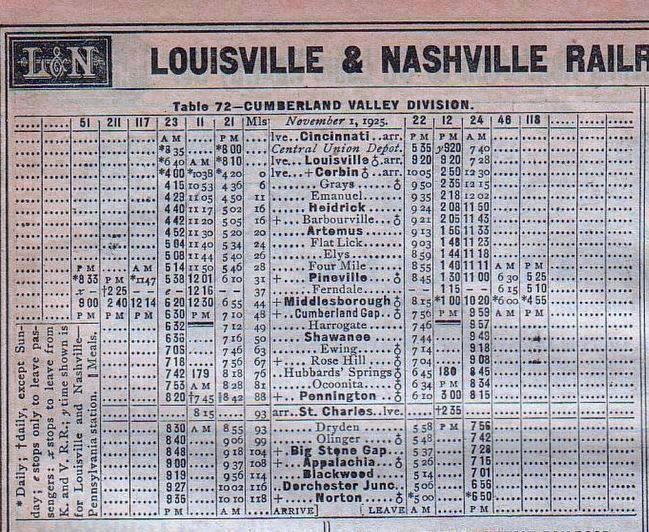
From page 525, The Official Guide of the Railways of the United States, Canada, Mexico and Cuba, December 1925
3. December 1925 L&N Timetable for the Cumberland Valley Division
The Pennington Gap stop is shown as Pennington. This 118 mile rail line runs from Corbin Kentucky to Norton Virginia via Cumberland Gap. Trains 21 and 23 originated at Louisville, splitting into two at Corbin with some cars continuing on to Atlanta and others on this timetable to Norton. The return trains 22 and 24 met Louisville-bound cars from Atlanta at Corbin for the return trip. Timetables indicate that passengers had to change trains in Louisville to reach Cincinnati. Stops between Corbin and Louisville are shown on a different timetable. Pennington Gap was a breakfast stop for train No. 21, the overnight train from Louisville. The line continues in service today for coal and freight traffic.
Credits. This page was last revised on June 16, 2016. It was originally submitted on November 24, 2015, by J. J. Prats of Powell, Ohio. This page has been viewed 1,799 times since then and 148 times this year. Photos: 1, 2, 3. submitted on November 24, 2015, by J. J. Prats of Powell, Ohio.

