Near Byron in Big Horn County, Wyoming — The American West (Mountains)
Sidon Canal
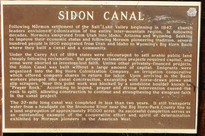
Under the Carey Act of 1894 states were encouraged to sell arable public land cheaply following reclamation. But private reclamation projects required capital, and some were aborted as investors lost faith. Unlike other privately-financed projects, the Sidon Canal was built without a large amount of capital. Emigrants were organized into the Big Horn Colonization Company, an irrigation cooperative which offered company shares in return for labor. Upon arriving in the Basin workers plunged into canal construction, excavating with horse-drawn plows and slip scrapers. Near this point work was blocked by a sandstone boulder known as “Prayer Rock.” According to legend, prayer and divine intervention caused the rock to split, allowing construction to continue and strengthening the emigrant faith in the canal project.
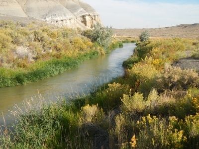
The 37-mile long canal was completed in less than two years. It still transports water from a headgate on the Shoshone River near the Big Horn-Park County line to a land segregation of approximately 20,000 acres. Its successful completion serves as an outstanding example of the cooperative effort and spirit of determination exhibited by Mormon pioneers in the American West.
Erected by Wyoming State Parks & Cultural Resources.
Topics. This historical marker is listed in these topic lists: Settlements & Settlers • Waterways & Vessels.
Location. 44° 46.404′ N, 108° 34.344′ W. Marker is near Byron, Wyoming, in Big Horn County. Marker is on Alternate U.S. 14A at milepost 35, on the right when traveling east. Touch for map. Marker is in this post office area: Byron WY 82412, United States of America. Touch for directions.
Other nearby markers. At least 8 other markers are within 10 miles of this marker, measured as the crow flies. Byron Sessions (approx. 3.9 miles away); The Mormon Colonists (approx. 8 miles away); Big Horn Academy (approx. 9.1 miles away); Cowley Log Community Center (approx. 9.1 miles away); Big Horn LDS Stake Office and Tithing Building (approx. 9.1 miles away); Deaver Reservoir (approx. 9.2 miles away); The Jeep (approx. 9.9 miles away); Henry Gilbert, Jr. Memorial (approx. 10 miles away).
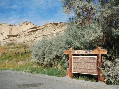
More about this marker. The marker is located at a turnout on the north side of U.S. Highway 14A about 3.2 miles west of Byron.
Credits. This page was last revised on June 16, 2016. It was originally submitted on December 4, 2015, by Barry Swackhamer of Brentwood, California. This page has been viewed 1,000 times since then and 104 times this year. Photos: 1, 2, 3. submitted on December 4, 2015, by Barry Swackhamer of Brentwood, California.


