Tyler in Smith County, Texas — The American South (West South Central)
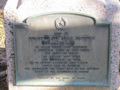
Site of Confederate Arms Factory
Confederate Arms Factory
Built in 1862
by Short, Biscoe and Company
A contract made in 1862 with
the State of Texas
to furnish 5000 guns
was annulled in 1863,
as needed material and labor
could not be secured.
The equipment was then sold to the govern-
ment of the Confederate States
Erected 1936 by State of Texas. (Marker Number 7714.)
Topics and series. This historical marker is listed in this topic list: War, US Civil. In addition, it is included in the Texas 1936 Centennial Markers and Monuments series list. A significant historical year for this entry is 1862.
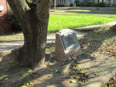
Location. 32° 20.168′ N, 95° 18.358′ W. Marker is in Tyler, Texas, in Smith County. Marker is at the intersection of South Robertson Avenue and Mockingbird Lane, on the left when traveling south on South Robertson Avenue. Touch for map. Marker is in this post office area: Tyler TX 75701, United States of America. Touch for directions.
Other nearby markers. At least 8 other markers are within walking distance of this marker. Woman's Building (approx. 0.3 miles away); Ordnance Plant (approx. 0.4 miles away); Chilton-Lipstate-Taylor House (approx. 0.4 miles away); Gary Elementary School (approx. 0.4 miles away); Rudolph Bergfeld (approx. 0.4 miles away); Whitaker-McClendon House (approx. half a mile away); The Connally Home (approx. half a mile away); Ramey House (approx. 0.6 miles away). Touch for a list and map of all markers in Tyler.
Regarding Site of Confederate Arms Factory. In 1863, Robertson Ave was the Tyler & Palestine Road, and was the west boundary of the facility. The main two story brick building was located about 120 yards to the east at about the present intersection of Mockingbird and Chilton Avenue.
Credits. This page was last revised on June 16, 2016. It was originally submitted on December 6, 2015, by Randal B. Gilbert of Tyler, Texas. This page has been viewed 863 times since then and 228 times this year. Photos: 1, 2. submitted on December 6, 2015, by Randal B. Gilbert of Tyler, Texas. • Bernard Fisher was the editor who published this page.

