Central Minneapolis in Hennepin County, Minnesota — The American Midwest (Upper Plains)
Welcome to the Historic Loring Park Neighborhood
Inscription.
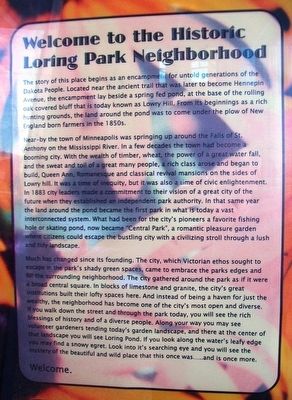
The story of this place begins as an encampment for untold generations of the Dakota People. Located near the ancient trail that was later to become Hennepin Avenue, the encampment lay beside a spring fed pond, at the base of the rolling oak covering bluff that is today known as Lowry Hill. From its beginnings as a rich hunting grounds, the land around the pond was to come under the plow of New England born farmers in the 1850s.
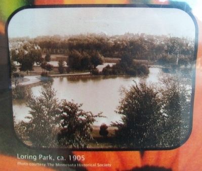
Near-by the town of Minneapolis was springing up around the Falls of St. Anthony on the Mississippi River. In a few decades the town had become a booming city. With the wealth of timber, wheat, the power of a great water fall, and the sweat and toil of a great many people, a rich class arose and began to build, Queen Ann[e], Romanesque and [C]lassical [R]evival mansions on the sides of Lowry [H]ill. It was a time of inequity, but it was also a time of civic enlightenment. In 1883 city leaders made a commitment to their vision of a great city of the future when they established an independent park authority. In that same year the land around the pond became the first park in what is today a vast interconnected system. What had been for the city's pioneers a favorite fishing hole or skating pond, now became "Central Park", a romantic pleasure garden where citizens could escape the bustling city with a civilizing stroll through a lush and tidy landscape.
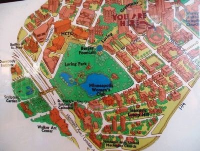
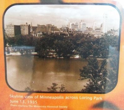
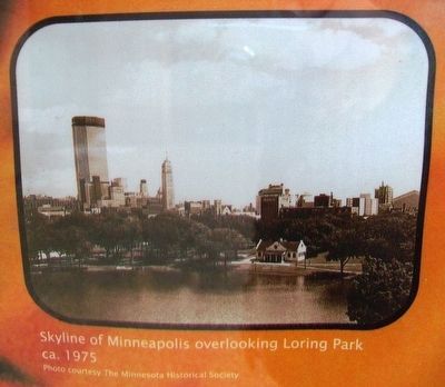
Much has changed since its founding. The city, which Victorian ethos sought to escape in the park's shady green spaces, came to embrace the parks edges and fill the surrounding neighborhood. The city gathered around the park as if it were a broad central square. In blocks of limestone and granite, the city's great institutions built their lofty spaces here. And instead of being a haven for just the wealthy, the neighborhood has become one of the city's most open and diverse. If you walk down the street and through the park today, you will see the rich blessings of history and of a diverse people. Along your way you may see volunteer gardeners tending today's garden landscape, and there at the center of that landscape you will see Loring Pond. If you look along the water's leafy edge you may find a snowy egret. Look into it's searching eye and you will see the mystery of the beautiful and wild place that this one was.....and is once more.
Welcome.
Topics. This historical marker is listed in this topic list: Notable Places. A significant historical year for this entry is 1883.
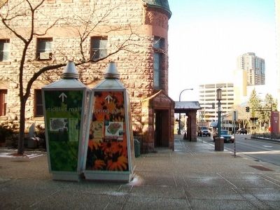
Location. 44° 58.181′ N, 93° 16.541′ W. Marker is in Minneapolis, Minnesota, in Hennepin County. It is in Central Minneapolis. Marker is on Grant Street east of Marquette Avenue / 1st Avenue, on the
right when traveling east. Touch for map. Marker is at or near this postal address: 101 East Grant Street, Minneapolis MN 55403, United States of America. Touch for directions.
Other nearby markers. At least 8 other markers are within walking distance of this marker. Wesley United Methodist Church (within shouting distance of this marker); USS Minnesota (BB22) (within shouting distance of this marker); USS Minneapolis (CA36) (within shouting distance of this marker); Eagles (about 300 feet away, measured in a direct line); Architects and Engineers Building (about 600 feet away); Loring Park: The Devil's Backbone (about 800 feet away); Loring Park: Historic Districts and Buildings (about 800 feet away); Loring Park: Basilica and Churches (about 800 feet away). Touch for a list and map of all markers in Minneapolis.
Also see . . .
1. About the Loring Park District. (Submitted on December 10, 2015, by William Fischer, Jr. of Scranton, Pennsylvania.)
2. Loring Park, A Minneapolis Neighborhood. (Submitted on December 10, 2015, by William Fischer, Jr. of Scranton, Pennsylvania.)
3. Citizens for a Loring Park Community. (Submitted on December 10, 2015, by William Fischer, Jr. of Scranton, Pennsylvania.)
Credits. This page was last revised on December 30, 2023. It was originally submitted on December 10, 2015, by William Fischer, Jr. of Scranton, Pennsylvania. This page has been viewed 748 times since then and 75 times this year. Photos: 1, 2, 3, 4, 5, 6. submitted on December 10, 2015, by William Fischer, Jr. of Scranton, Pennsylvania.
