Near Buffalo in Johnson County, Wyoming — The American West (Mountains)
Tisdale Divide
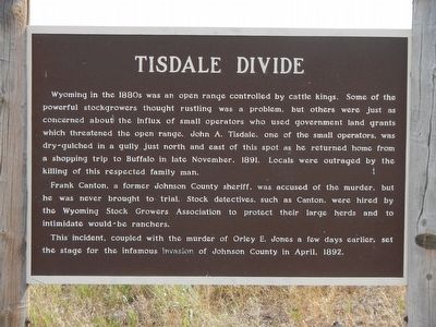
Frank Canton, a former Johnson County sheriff, was accused of the murder, but was never brought to trial. Stock detectives, such as Canton, were hired by the Wyoming Stock Growers Association to protect their large herds and to intimidate would-be ranchers.
This incident, coupled with the murder of Orley E. Jones a few days earlier, set the stage for the infamous invasion of Johnson County in April, 1892.
Erected by Wyoming State Parks & Cultural Resources.
Topics. This historical marker is listed in this topic list: Notable Events.
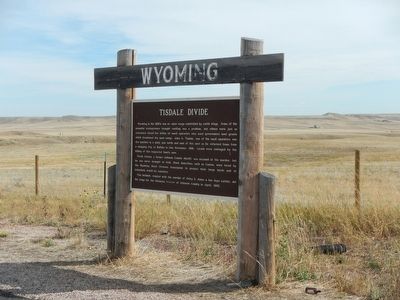
Location. 44° 14.22′ N, 106° 42.336′ W. Marker is near Buffalo, Wyoming, in Johnson County. Marker is on Old Highway 87 (at milepost 293) near Buffalo Sussex Cutoff Road, on the right when traveling north. Touch for map. Marker is at or near this postal address: 29201 Old Highway 87, Buffalo WY 82834, United States of America. Touch for directions.
Other nearby markers. At least 8 other markers are within 8 miles of this marker, measured as the crow flies. TA Ranch (approx. 5.7 miles away); Veteran's Home of Wyoming War Memorials (approx. 6.8 miles away); Fort McKinney (approx. 7.3 miles away); Greenbelt Trail–Klondike Access (approx. 7.4 miles away); Pelloux Bridge (approx. 7˝ miles away); Living on the Edge (approx. 7˝ miles away); Washington Park Trailhead (approx. 7˝ miles away); Crazy Woman Story (approx. 7.6 miles away). Touch for a list and map of all markers in Buffalo.
Additional keywords. Johnson County War
Credits. This page was last revised on September 26, 2020. It was originally submitted on December 14, 2015, by Barry Swackhamer of Brentwood, California. This page has been viewed 1,112 times since then and 75 times this year. Photos: 1, 2, 3. submitted on December 14, 2015, by Barry Swackhamer of Brentwood, California.


