Centro Histórico in Ciudad de México, Mexico — The Valley of Mexico (The Central Highlands)
Calle de las Carreras
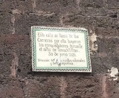
Esta calle se llamó de las Carreras por ella huyeron los conquistadores durante el sitio de Tenochtitlan.
30 de junio de 1521.
This street was called "Getaway Street" (Calle Las Carreras) as it was here that the Conquistadors fled from the siege of Tenochtitlán.
June 30, 1521
Erected by Dirección de Monumentos Coloniales y de la República.
Topics. This historical marker is listed in these topic lists: Colonial Era • Wars, Non-US. A significant historical date for this entry is June 30, 1521.
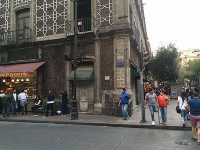
Location. 19° 26.061′ N, 99° 8.164′ W. Marker is in Ciudad de México. It is in Centro Histórico. Marker is at the intersection of Calle Isabel la Católica and 5 de Mayo, on the right when traveling north on Calle Isabel la Católica. Touch for map. Marker is at or near this postal address: Calle Isabel la Católica 26C, Ciudad de México 06000, Mexico. Touch for directions.
Other nearby markers. At least 8 other markers are within walking distance of this marker. Hotel Gillow (within shouting distance of this marker); Dulcería de Celaya (within shouting distance of this marker); El Gran Café La Concordia (about 90 meters away, measured in a direct line); Café La Concordia (about 90 meters away); The Museum of the Estanquillo (about 90 meters away); La Droguería Plateros (about 120 meters away); Temple of the Professed or San José del Real (about 120 meters away); Hernán Cortés' Residences (about 120 meters away). Touch for a list and map of all markers in Ciudad de México.
Regarding Calle de las Carreras. This marker describes part of the "Night of Sorrows" (La Noche Triste) when the Spanish and their allies broke through the Mexica siege and fled from the enraged attackers along the causeways out of the city. Some 400-800 Spanish were killed and some 2,000 to 4,000 of their Tlaxcala and other allies were either captured or killed. Cortés supposedly broke down and cried at the end of the night due to the heavy losses and the desperate situation. After regrouping, his forces later attacked Tenochtitlan again, this time putting it under seige and eventually gaining control of the future Mexico City on August 31, 1521.
Credits. This page was last revised on May 17, 2021. It was originally submitted on December 16, 2015, by J. Makali Bruton of Accra, Ghana. This page has been viewed 418 times since then and 7 times this year. Photos: 1, 2. submitted on December 16, 2015, by J. Makali Bruton of Accra, Ghana.

