Casper in Natrona County, Wyoming — The American West (Mountains)
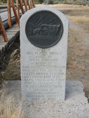
Site of Old Platte Bridge
Louis Gurnard
1858-59
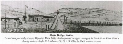
Immediately south and west are the sites of Platte Bridge Station, First Overland Telegraph, Stage, and Pony Express Stations on the Old Oregon Trail
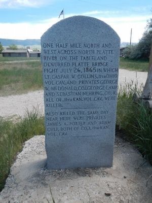
opposite side:
Also killed the same day near here were Privates James A. Porter and Adam Culp, both of Co. I, 11th Kan. Vol. Cav.
Erected 1930 by Natrona County Historical Society.
Topics and series. This historical marker is listed in these topic lists: Bridges & Viaducts • Wars, US Indian. In addition, it is included in the Oregon Trail series list.
Location. 42° 50.258′ N, 106° 22.297′ W. Marker is in Casper, Wyoming, in Natrona County. Marker can be reached from Fort Caspar Road near Southwest Wyoming Boulevard (Route 258), on the right when traveling west. Touch for map. Marker is at or near this postal address: 4001 Fort Caspar Road, Casper WY 82604, United States of America. Touch for directions.
Other nearby markers. At least 8 other markers are within walking distance of this marker. Guinard Bridge (here, next to this marker); The Upper Crossing (here, next to this marker); The Road to Zion (a few steps from this marker); The Mormon Ferry (a few steps from this marker); Reconstructed Fort Caspar (about 300 feet away, measured in a direct line); The Battle at Platte Bridge (about 300 feet away); The Battle of Red Buttes (about 400 feet away); Old Fort Caspar (about 500 feet away). Touch for a list and map of all markers in Casper.
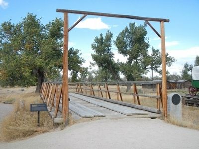
More about this marker. This marker is next to the reconstruction of Platte Bridge.
Credits. This page was last revised on June 17, 2016. It was originally submitted on December 19, 2015, by Barry Swackhamer of Brentwood, California. This page has been viewed 546 times since then and 31 times this year. Photos: 1. submitted on December 19, 2015, by Barry Swackhamer of Brentwood, California. 2. submitted on June 14, 2016, by Barry Swackhamer of Brentwood, California. 3, 4. submitted on December 19, 2015, by Barry Swackhamer of Brentwood, California.


