Orinda in Contra Costa County, California — The American West (Pacific Coastal)
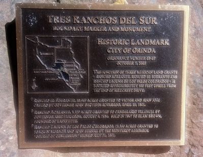
Tres Ranchos Del Sur
Boundary Marker and Monument
— Historic Landmark - The City of Orinda —
October 7, 2003
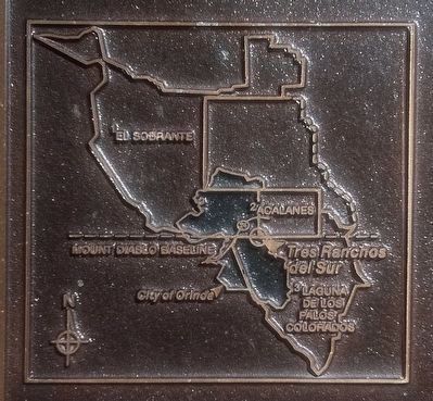
(The superscripts below refer to the numbers on the marker inset map. identifying the individual ranchos.)
1 Rancho El Sobrante, 20,565 acres granted Victor and Juan Jose Castro by Governor Juan Bautista Alvarado, April 23, 1841.
2 Rancho Acalanes, 3,329 acres granted to Candelario Valencia by Governor Jose Figueroa, August 5, 1834. Sold in 1847 to Elam Brown, founder of Lafayette.
3 Rancho Laguna de Los Palos Colorados, 13,300 acres granted to Joaquin Moraga and Juan Bernal by the Monterey Assembly. "Decree of Concession" signed July 31, 1841.
Topics. This historical marker is listed in this topic list: Settlements & Settlers. A significant historical date for this entry is April 23, 1841.
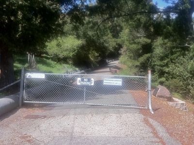
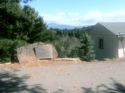
Location. 37° 52.787′ N, 122° 9.884′ W. Marker is in Orinda, California, in Contra Costa County. Marker is on Hillcrest Drive north of Overhill Road. Touch for map. Marker is at or near this postal address: 199 Hillcrest Drive, Orinda CA 94563, United States of America. Touch for directions.
Other nearby markers. At least 8 other markers are within one mile of this marker, measured as the crow flies. The de Laveaga Station (approx. 0.9 miles away); The deLaveaga Station (approx. 0.9 miles away); The Orinda Theatre, 1941 (approx. one mile away); The Pony Express (approx. one mile away); Bryant Station Site (approx. one mile away); a different marker also named Pony Express (approx. one mile away); The Crossroads (approx. one mile away); Orinda Mural (approx. 1.1 miles away). Touch for a list and map of all markers in Orinda.
Credits. This page was last revised on June 16, 2016. It was originally submitted on December 27, 2015, by Andrew Ruppenstein of Lamorinda, California. This page has been viewed 478 times since then and 19 times this year. Photos: 1, 2, 3, 4. submitted on December 27, 2015, by Andrew Ruppenstein of Lamorinda, California.


