Sainte-Mère-Église in Manche, Normandy, France — Western Europe
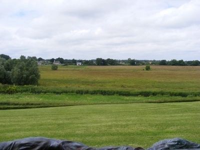
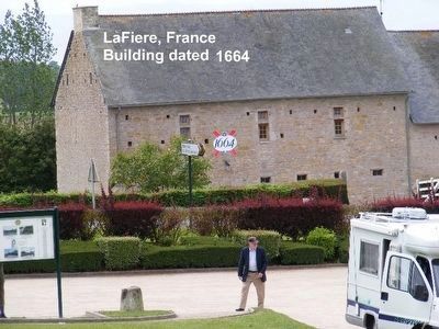
6 June 1944 at LaFiere Bridge
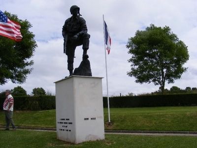
Iron Mike Monument at LaFiere Bridge
— Memorial Parachutiste —
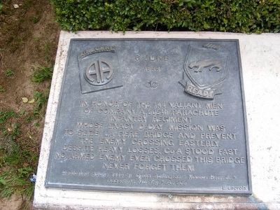
In honor of the 144 valiant men of Company A, 505th Parachute Infantry Regiment whose exact D-Day mission was to seize La Fiere Bridge and prevent the enemy crossing easterly. Despite heavy losses, Co. A stood fast. No enemy ever crossed this bridge. Never forget them.
Erected 1999 by David Bullington*Marcus Heim Jr.*Robert M. Murphy*A.505.
Topics. This memorial is listed in this topic list: War, World II.
Location. 49° 24.085′ N, 1° 21.768′ W. Marker is in Sainte-Mère-Église, Normandie (Normandy), in Manche. Memorial is on Moulin (D15). Touch for map. Marker is in this post office area: Sainte-Mère-Église, Normandie 50480, France. Touch for directions.
Other nearby markers. At least 8 other markers are within 14 kilometers of this marker, measured as the crow flies. 80th Airborne Antiaircraft Battalion, 82nd Airborne Div. U.S. Army (here, next to this marker); PFC Charles DeGlopper Memorial (here, next to this marker); General Gavin’s Foxhole (about 90 meters away, measured in a direct line); In Remembrance of the Airborne Spirit (approx. 3.4 kilometers away); 82nd and 101st Airborne on D-Day (approx. 3.4 kilometers away); Clifford A. Maughan P.F.C. (approx. 3.4 kilometers away); House on Fire at Sainte-Mère-Église (approx. 3.6 kilometers away); U.S. Coast Guard Memorial at Utah Beach (approx. 13.7 kilometers away). Touch for a list and map of all markers in Sainte-Mère-Église.
Credits. This page was last revised on September 10, 2018. It was originally submitted on January 3, 2016, by Don Morfe of Baltimore, Maryland. This page has been viewed 319 times since then and 19 times this year. Photos: 1, 2, 3, 4. submitted on January 3, 2016, by Don Morfe of Baltimore, Maryland. • Andrew Ruppenstein was the editor who published this page.


