Southwest Quadrant in Alexandria, Virginia — The American South (Mid-Atlantic)
Alexandria National Cemetery
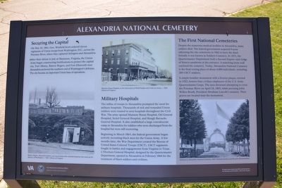
Securing the Capital
On May 24, 1861, Gen. Winfield Scott ordered eleven regiments of Union troops from Washington, D.C., across the Potomac River, where they captured Arlington and Alexandria.
After their defeat in July at Manassas, Virginia, the Union Army began constructing fortifications to protect the capital city. Fort Albany, Battery Rogers, and Fort Ellsworth near Alexandria anchored the southern end of Washington's defenses. The city became an important Union base of operations.
Military Hospitals
The influx of troops to Alexandria prompted the need for military hospitals. Thousands of sick and wounded Union soldiers were treated in area hospitals throughout the Civil War. The army opened Madison House Hospital, Old General Hospital, Sickel General Hospital, and Slough Barracks General Hospital. It also established a large convalescent camp in Alexandria for soldiers who were discharged from the hospital but were still recovering.
Beginning if March 1863, the federal government began actively recruiting black men for the Union Army. A few months later, the War Department created the Bureau of United States Colored Troops (USCT). USCT regiments fought in battles and engagements from Virginia to Texas. L'Overture General Hospital, designed by the Quartermaster Department, opened in Alexandria in February 1864 for the treatment of black soldiers and civilians.
(sidebar)
The First National Cemeteries
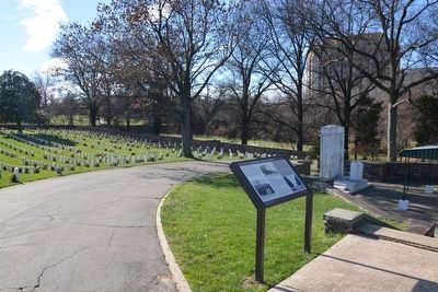
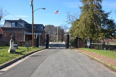
Despite the numerous medical facilities in Alexandria, many soldiers died. The federal government acquired 4 acres adjoining the city cemeteries in 1862 to bury the dead. Initially it was known as Soldiers Cemetery. In 1871, the Quartermaster Department built a Second Empire-style lodge of Seneca sandstone at the entrance. A matching stone wall enclosed the cemetery. Today, Alexandria National Cemetery is the final resting place of about 4,000 individuals, including 280 USCT soldiers.
A simple boulder monument with a bronze plaque, erected in 1922, honors four civilian employees of the U.S. Army Quartermaster Corp. The men drowned attempting to cross the Potomac River on April 24, 1865, while pursuing John Wilkes Booth, President Abraham Lincoln's assassin. Their graves are located near the monument.
Erected 2015 by U.S. Department of Veterans Affairs, National Cemetery Administration.
Topics and series. This historical marker is listed in these topic lists: African Americans • Cemeteries & Burial Sites • War, US Civil. In addition, it is included in the Defenses of Washington, and the National Cemeteries series lists. A significant historical date for this entry is May 24, 1861.
Location. 38° 48.098′ N, 77° 3.492′ W. Marker is in Alexandria, Virginia. It is in the Southwest Quadrant. Marker can be reached from Wilkes Street west of Hamilton Avenue when traveling west. Marker is inside the Alexandria National Cemetery. Touch for map. Marker is at or near this postal address: 1450 Wilkes St, Alexandria VA 22314, United States of America. Touch for directions.
Other nearby markers. At least 8 other markers are within walking distance of this marker. "Pursuers of Booth the Assassin" (a few steps from this marker); In Honor of Those Who Gave the Ultimate Sacrifice (a few steps from this marker); A National Cemetery System (within shouting distance of this marker); Hooff's Run Bridge (about 500 feet away, measured in a direct line); Old Presbyterian Meeting House (about 500 feet away); The West End (about 600 feet away); African American Heritage Memorial (about 600 feet away); Douglass Cemetery (about 600 feet away). Touch for a list and map of all markers in Alexandria.
Also see . . . U.S. Department of Veterans Affairs, National Cemetery Administration. (Submitted on January 10, 2016.)
Credits. This page was last revised on January 27, 2023. It was originally submitted on January 8, 2016, by A. Taylor of Laurel, Maryland. This page has been viewed 635 times since then and 27 times this year. Photos: 1, 2, 3. submitted on January 8, 2016, by A. Taylor of Laurel, Maryland. • Bernard Fisher was the editor who published this page.


