Bailey's Prairie in Brazoria County, Texas — The American South (West South Central)
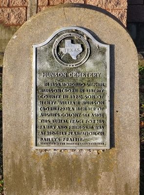
Munson Cemetery
Erected 1966 by State Historical Survey Committee. (Marker Number 9577.)
Topics. This historical marker is listed in these topic lists: Cemeteries & Burial Sites • Settlements & Settlers. A significant historical year for this entry is 1850.
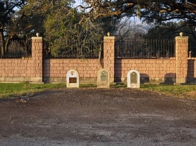
Location. 29° 8.778′ N, 95° 31.351′ W. Marker is in Bailey's Prairie, Texas, in Brazoria County. Marker is at the intersection of Jimmy Phillips Boulevard (State Highway 35) and Munson Ranch Road, on the right when traveling west on Jimmy Phillips Boulevard. One of three markers at this roadside pull-off. Touch for map. Marker is at or near this postal address: 1960 Jimmy Phillips Boulevard, Angleton TX 77515, United States of America. Touch for directions.
Other nearby markers. At least 8 other markers are within 6 miles of this marker, measured as the crow flies. "Brit" Bailey Plantation (here, next to this marker); James Briton "Brit" Bailey (here, next to this marker); Stephen F. Austin, Father of Texas (approx. 4.4 miles away); First Baptist Church of Angleton (approx. 4.9 miles away); First Missionary Baptist Church of Angleton (approx. 5.3 miles away); The Nash-Wright House (approx. 5.4 miles away); Bethel Presbyterian Church (approx. 5.4 miles away); James & Selina Phillips House (approx. 5.4 miles away). Touch for a list and map of all markers in Bailey's Prairie.
Also see . . . Article from The Handbook of Texas. (Submitted on January 15, 2016, by Jim Evans of Houston, Texas.)
Credits. This page was last revised on January 31, 2019. It was originally submitted on January 15, 2016, by Jim Evans of Houston, Texas. This page has been viewed 853 times since then and 69 times this year. Photos: 1, 2, 3. submitted on January 15, 2016, by Jim Evans of Houston, Texas. • Bernard Fisher was the editor who published this page.


