Montego Bay, St James Parish, Jamaica — Caribbean Region of the Americas (Greater Antilles of the West Indies)
Montego Bay History
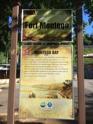
Fort Montego
The area was settled by the Taino. Columbus arrived in 1494 on the 2nd voyage, anchored in the bay and called it Golfo de Buen Tiempo or the Gulf of Good Weather. The Spanish used it to ship Manteca or Lard from the slaughtering of wild hogs. The name Montego is derived from the Bay of Lard or Manteca. The town played roles in the second Maroon War 1795-1796 and again in the 1831-1832 rebellions by the enslaved against slavery. Since the start of the 20th century it became a major international tourist destination.
Erected by Jamaica National Heritage Trust.
Topics. This historical marker is listed in these topic lists: Settlements & Settlers • Wars, Non-US. A significant historical year for this entry is 1494.
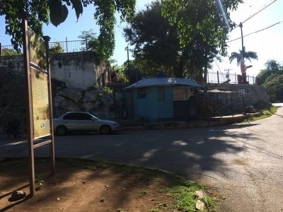
Location. 18° 28.715′ N, 77° 55.586′ W. Marker is in Montego Bay, St James Parish. Marker is on Fort Street close to Gloucester Avenue, on the left when traveling east. Touch for map. Touch for directions.
Other nearby markers. At least 8 other markers are within walking distance of this marker. Fort Montego History (within shouting distance of this marker); Fort Montego Cannons (within shouting distance of this marker); Fort Montego Armoury (about 90 meters away, measured in a direct line); Old Hospital Park (approx. 0.4 kilometers away); The Cage (approx. 0.6 kilometers away); Sam Sharpe (approx. 0.6 kilometers away); Montego Bay Civic Centre (approx. 0.6 kilometers away); Jamaica's Independence and Royal Visit (approx. 0.7 kilometers away). Touch for a list and map of all markers in Montego Bay.
Credits. This page was last revised on July 7, 2022. It was originally submitted on January 16, 2016, by J. Makali Bruton of Accra, Ghana. This page has been viewed 483 times since then and 34 times this year. Photos: 1, 2. submitted on January 16, 2016, by J. Makali Bruton of Accra, Ghana.

