Guatemala City in Guatemala Department, — Central America
First Council of the City of Guatemala
First Council of the New Guatemala of the Assumption
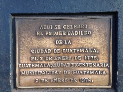
el Primer Cabildo
de la
Ciudad de Guatemala,
el 2 de enero de 1776.
Guatemala, Ciudad Bicentenaria
Municipalidad de Guatemala
2 de enero de 1976.
The First City Council of the
City of Guatemala.
January 2, 1776.
Guatemala, Bicentennial City
Municipality of Guatemala
January 2, 1976.
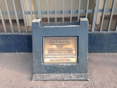
Erected 1976 by Municipalidad de Guatemala.
Topics. This historical marker is listed in these topic lists: Colonial Era • Government & Politics • Settlements & Settlers. A significant historical date for this entry is January 2, 1976.
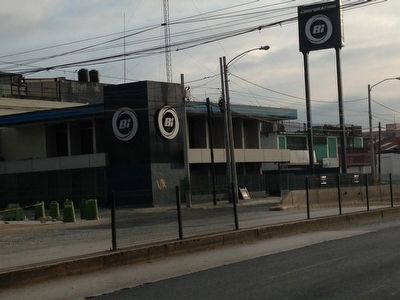
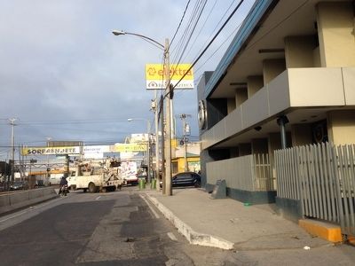
Location. 14° 39.044′ N, 90° 29.936′ W. Marker is in Guatemala City, Guatemala (Guatemala Department). Marker is on Calle Marti, 0 kilometers 15 Avenida, on the left when traveling east. Across the street from the church of La Parroquia, on the side of the building (2016 Banco Industrial). Touch for map. Marker is in this post office area: Guatemala City, Guatemala 01001, Guatemala. Touch for directions.
Other nearby markers. At least 8 other markers are within walking distance of this marker. The Mexican Fountain at El Cerrito del Carmen (approx. 0.7 kilometers away); Our Lady of Carmen Catholic Church (approx. 0.8 kilometers away); Juan Corz (approx. 0.8 kilometers away); General Francisco Morazán (approx. 1.5 kilometers away); Jocotenango Park (approx. 1.5 kilometers away); Lieutenant Colonel and Engineer Francisco Vela (approx. 1.5 kilometers away); Engineer Francisco Vela (approx. 1.5 kilometers away); Engineer Claudio Urrutia M. (approx. 1.5 kilometers away). Touch for a list and map of all markers in Guatemala City.
Regarding First Council of the City of Guatemala. "La Nueva Guatemala de La Asuncion" was founded on January 2, 1776. This was the fourth and last time that the center of the Kingdom and Captaincy of Guatemala relocated to a new province. The previous location, Ciudad Santiago de Los Caballeros (known today as Antigua), was nearly destroyed by the earthquakes on St. Martha's Day, July 29, 1773.
The complexity of the financial stakes, internal municipal conflicts, ecclesiastical and social pressures, and ancient-regime control, all influenced the debates over the city's relocation. On July 21, 1775, King Charles III of Spain ordered a Royal Decree to the President of the Audience of Guatemala authorizing the construction of the new city.
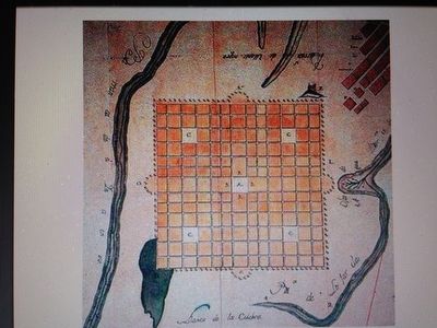
On January 2, 1776, Officials of the City Council (Primer Cabildo) met for the first time in the Ayuntamiento building, in an area of the current city limits known today as La Parroquia. Luis Diez Navarro was the original architect, commissioned by the Spanish Monarchy, to submit his drawings of the city plans.
A marker, near the church of La Parroquia, commemorates this monumental event.
Also see . . . Bicentennial of Guatemala City. (Submitted on March 3, 2016, by Jo Solorzano of San Francisco, California.)
Credits. This page was last revised on March 2, 2018. It was originally submitted on February 5, 2016, by Jo Solorzano of San Francisco, California. This page has been viewed 291 times since then and 4 times this year. Photos: 1, 2, 3, 4, 5, 6. submitted on February 5, 2016, by Jo Solorzano of San Francisco, California. • Bill Pfingsten was the editor who published this page.
