New Site in Tallapoosa County, Alabama — The American South (East South Central)
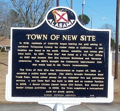
Town of New Site
The Town of New Site was incorporated on August 23, 1965, to establish a public water system. The 1980’s brought Horseshoe Bend Trade Days, which raised money for the volunteer fire and ambulance services. A new Town Hall was built in 1989 and an outdoor pavilion in 2003. A Senior Citizen Center houses Girl Scouts, Boy Scouts and Senior Citizen activities. In 2008, the Town completed a recreational park for youth sports.
Erected 2015 by Alabama Historical Association.
Topics and series. This historical marker is listed in this topic list: Settlements & Settlers. In addition, it is included in the Alabama Historical Association series list.
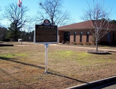
Location. 33° 2.118′ N, 85° 46.734′ W. Marker is in New Site, Alabama, in Tallapoosa County. Marker is on Alabama Route 22, 0.3 miles west of Hamlet Mill Road (Alabama Route 49), on the right when traveling west. Touch for map. Marker is at or near this postal address: 12791 AL-22, Daviston AL 36256, United States of America. Touch for directions.
Other nearby markers. At least 8 other markers are within 5 miles of this marker, measured as the crow flies. Battle Of Emucfau (approx. ¼ mile away); Goldville (approx. 3.4 miles away); Horseshoe Bend Campaign Combatants (approx. 4.4 miles away); Horseshoe Bend National Military Park (approx. 4.6 miles away); A Bloody Contest (approx. 4.6 miles away); Miller Covered Bridge (approx. 4.6 miles away); Who Were the Creek? (approx. 4.6 miles away); Futile Escape (approx. 4.7 miles away).
Also see . . . Town of New Site. (Submitted on February 9, 2016.)
Credits. This page was last revised on June 16, 2016. It was originally submitted on February 7, 2016, by David J Gaines of Pinson, Alabama. This page has been viewed 414 times since then and 57 times this year. Photos: 1, 2. submitted on February 7, 2016, by David J Gaines of Pinson, Alabama. • Bernard Fisher was the editor who published this page.

