Holley in Orleans County, New York — The American Northeast (Mid-Atlantic)
The Holley Loop
The Canalway Trail
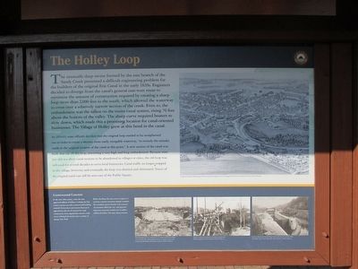
The Holley Loop
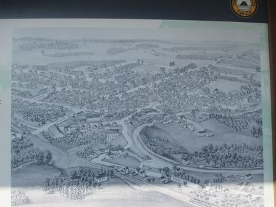
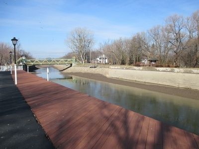
The unusually deep ravine formed by the east branch of the Sandy Creek presented a difficult engineering problem for the builders of the original Erie Canal in the early 1820s. Engineers decided to diverge from the canal's general east-west route to minimize the amount of construction required by creating a sharp loop more than 2,000 feet to the south, which allowed the waterway to cross over a relatively narrow section of the creek. Even so, the embankment was the tallest on the entire canal system, rising 76 feet above the bottom of the valley. The sharp curve required boaters to slow down, which made this a promising location for canal-oriented businesses. The Village of Holley grew at this bend in the canal.
In 1854-61, state officials decided that the original loop needed to be straightened out in order to create a shorter, more easily navigable waterway, "to remedy the mistake made in the original location of the canal at this point." A new section of the canal was built that cut off this loop, traversing a very high and long embankment. Because state law did not allow canal sections to be abandoned in villages or cities, the old loop was still used for several decades to serve local businesses. Canal traffic no longer stopped in the village, however, and eventually the loop was drained and eliminated. Traces of the original canal can still be seen east of the Public Square.
Controversial Concrete
In the early 20th century, when the state approved millions of dollars to enlarge the Erie Canal, concrete was still a controversial building material. Stonecutters and masons lined up in opposition to the use of concrete for canal construction. Some argued that concrete could never withstand the harsh winter weather of upstate New York.
Before deciding, the state sent an engineer to examine concrete structures already complete. He consulted experts familiar with concrete. Accountants tallied the cost and reported that stone structures would cost 16 million additional dollars. The state chose concrete.
The trough that tops the embankment over Sandy Creek at Holley was one of the most striking demonstrations of concrete construction on the entire Erie Barge Canal System.
Masive amounts of concrete were used to construct the Medina Aqueduct in 1913.
Locks on the present day Erie Barge Canal, such as lock 17 in Little Falls, were built with concrete rather than stone.
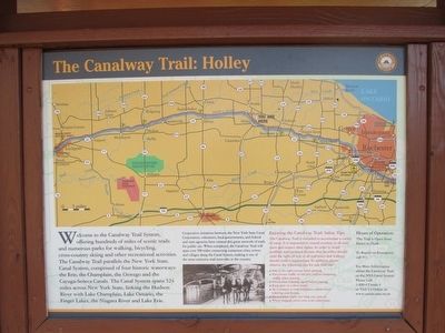
The Canalway Trail: Holley
Welcome to the Canalway Trail System, offering hundreds of miles of scenic trails and numerous parks for walking, bicycling, cross-country skiing and other recreational activities. The Canalway Trail parallels the New York State Canal System, comprised
of four historic waterways: the Erie, the Champlain, the Oswego and the Cayuga-Seneca Canals. The Canal System spans 524 miles across New York State, linking the Hudson River with Lake Champlain, Lake Ontarion, the Finger Lakes, the Niagara River and Lake Erie.
Cooperative initiaives between the New York State Canal Corporation, volunteers, local governments, and federal agencies have created this great network of trails for public use. When completed, the Canalway Trail will span over 500 miles connecting numerous cities, towns and villages along the Canal System, making it one of the most extensive trail networks in the country.
Enjoying the Canalway Trail: Safety Tips
The Canalway Trail is intended to accomodate a variety of users. It is important to extend courtesy to all trail users and respect their rights. In order to avoid conflicts, trial protocal dictates that bicyclists should yield right-of-way to all trail users and walkers should yield to equestrians. In addition, please observe the following tips for safe trail use:
• Stay to the right except when passing.
• Pass slower traffic on the left; yield to oncoming traffic when passing.
• Give a clear warning signal before passing.
• Keep pets on a short leash.
• As a courtesy to trail neighbors, refrain from loitering near homes.
• Do not litter. Carry out what you carry in.
• When stopped, move over to let others pass.
Erected by New York State Canals.
Topics and series. This historical marker is listed in this topic list: Waterways & Vessels. In addition, it is included in the Erie Canal series list. A significant historical year for this entry is 1913.
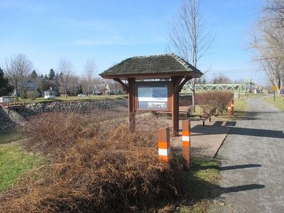
Location. 43° 13.689′ N, 78° 1.251′ W. Marker is in Holley, New York, in Orleans County. Marker is on East Avenue, on the right when traveling east. Marker is on the north bank of the Erie Barge Canal, on the trail. On Google Maps, it is the Erie Canal Heritage Trail. The shelter-style marker can be seen from the East Avenue canal bridge. Walk the path southward from the end of the bridge. Touch for map. Marker is in this post office area: Holley NY 14470, United States of America. Touch for directions.
Other nearby markers. At least 8 other markers are within walking distance of this marker. First Norwegian Immigrants Landed in Holley, 1825 (within shouting distance of this marker); 1823 Canal Bed (approx. ¼ mile away); Holley Railway Depot (approx. ¼ mile away); In Memory of All Those Servicemen (approx. ¼ mile away); In Honor of All Veterans (approx. 0.3 miles away); Safe House / Brainard Home (approx. 0.4 miles away); State Street (approx. half a mile away); Eastern Orleans Memorial Post 202 (approx. 0.6 miles away). Touch for a list and map of all markers in Holley.
Photographed By Anton Schwarzmueller, February 7, 2016
6. Trail to Park and Downtown
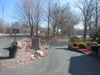
Andrew Cuomo Canalway Trail, Holley, N.Y., August 9, 2000. This trail generally follows the bed of the original canal loop towards downtown Holley. The Erie Barge Canal is at left. This is at the parking area on the opposite side of the canal from the marker.
Credits. This page was last revised on June 16, 2016. It was originally submitted on February 8, 2016, by Anton Schwarzmueller of Wilson, New York. This page has been viewed 568 times since then and 42 times this year. Photos: 1, 2, 3, 4, 5, 6. submitted on February 8, 2016, by Anton Schwarzmueller of Wilson, New York.
