Central Clintonville in Columbus in Franklin County, Ohio — The American Midwest (Great Lakes)
Clintonville / Clinton Township
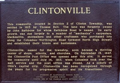
This community located in Section 2 of Clinton Township, was settled in 1813 by Thomas Bull. The land was formerly owned by John Rathbone for whom Rathbone Road is named. Its early growth was due largely to a number of “mechanics”- carpenters, blacksmiths, shoemakers and other craftsmen who purchased lots along the Columbus- Worthington Road (present North High Street) and established their homes and businesses. Clintonville, named for the township, soon became a thriving center of shops, schools, and churches. OnSeptember 13, 1847, the Clintonville Post Office was opened near this site. It served this community until July 14, 1917, when Columbus took over the mail service and the post office was closed. As a suburb of Ohio’s capital city, Clintonville has been recognized through the years for its progressive spirit and its friendliness.
Franklin County, Ohio
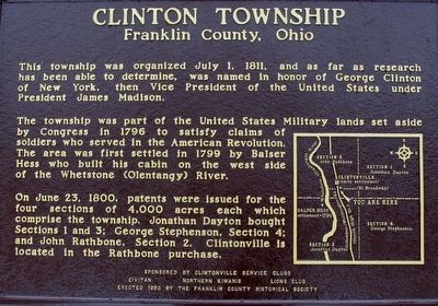
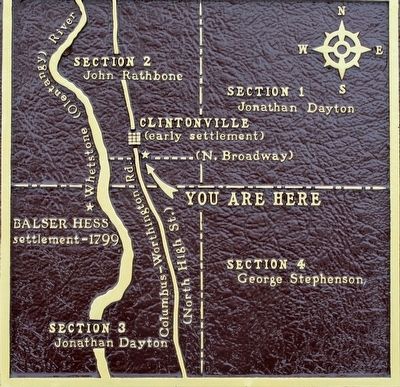
This township was organized July 1, 1811, and as far as research has been able to determine, was named in honor of George Clinton of New York, then Vice President of the Unites States under President James Madison. The township was part of the United States Military lands set aside by Congress in 1796 to satisfy the claims of soldiers who sereved in the American Revolution. The are was first settles in 1799 by Balser Hess who built his cabin on the west side of the Whetstone (Olentangy) River. On June 23, 1800, patents were issued for the four sections of 4,000 acres each which comprise this township. Jonathan Dayton bought Sections 1 and 3; George Stephenson, Section 4; and John Rathbone, Section 2. Clintonville is locateg in the Rathbone purchase. (map)
Erected 1960 by Clintonville Service Clubs Civitan North Kiwanis Lions Club Franklin County Historical Society.
Topics and series. This historical marker is listed in this topic list: Settlements & Settlers. In addition, it is included in the Former U.S. Presidents: #04 James Madison series list.
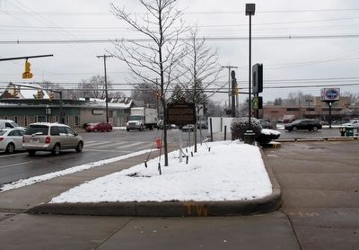
Location. 40° 1.902′ N, 83° 0.93′ W. Marker is in Columbus, Ohio, in Franklin County. It is in Central Clintonville. Marker is at the intersection of North High (U.S. 23) and East North Broasway, on the right when traveling north on North High. marker was first set at this location in 1960. In 1971, it was moved to the Clintonville Woman's Club, due to construction. Recently (2014- 15) the marker was removed for renovation. It was reset at the original location. Touch for map. Marker is at or near this postal address: 12 East North Broadway, Columbus OH 43214, United States of America. Touch for directions.
Other nearby markers. At least 8 other markers are within 2 miles of this marker, measured as the crow flies. Clinton Township High School / East North Broadway Historic District (within shouting distance of this marker); Clinton Theater / Memory Lane (about 300 feet away, measured in a direct line); Rand P. Hollenback (approx. 0.7 miles away); Clintonville Woman's Club (approx. 0.8 miles away); Philo Webster and Webster Graveyard (approx. 1.1 miles away); Bill Moose (approx. 1.1 miles away); Dominion Land Company Mound An Early Woodlands Period Structure/Sunwall and Moonwall Murals (approx. 1.3 miles away); Coach Woody Hayes (approx. 1.4 miles away). Touch for a list and map of all markers in Columbus.
Credits. This page was last revised on February 3, 2023. It was originally submitted on March 4, 2016, by Rev. Ronald Irick of West Liberty, Ohio. This page has been viewed 817 times since then and 58 times this year. Photos: 1, 2, 3, 4, 5, 6. submitted on March 4, 2016, by Rev. Ronald Irick of West Liberty, Ohio. • Bill Pfingsten was the editor who published this page.
