Ciudad Colonial in Santo Domingo, Distrito Nacional, Dominican Republic — Caribbean Region of the Americas (Hispaniola, Greater Antilles, West Indies)
The Colonial City of Santo Domingo
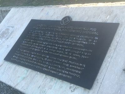
En la XIV reunión del Comité del Patrimonio Mundial celebrada en Banff, Canada en diciembre de 1990, por su influencia en la arquitectura y el urbanismo de América, por su valor histórica y por esta asociado a eventos y hechos de trascendencia universal.
La ciudad de Santo Domingo fue fundada por el Adelantado Don Bartolomé Colón el 5 de agosto de 1498 siguiendo instrucciones de los Reyes Católicos y de su Almirante Don Cristóbal Colón, en la margen oriental del Rio Ozama, siendo trasladada a la parte occidental del mismo por Nicolás de Ovando en 1502.
Su trazado urbano a damero sirvió de modelo a otras poblaciones españoles en el nuevo continente. La ciudad colonial de Santo Domingo posee importantes primicias americanas como son: La Real Audiencia y Chancillería, Ayuntamiento Estable, La Catedral Santa María de la Encarnación, El Monasterio de San Francisco, El Hospital San Nicolás de Bari y La Universidad de Santo Domingo, entre otros.
during the 14th meeting of the World Heritage Committee held in Banff, Canada in December 1990 for its influence on architecture and urbanism in the Americas, its historical value and its association with events and facts of universal significance.
The city of Santo Domingo was founded by Governor Bartolomé Colón on August 5, 1498 following the instructions of the Catholic Kings of Spain and his admiral Christopher Columbus, on the east bank of the Rio Ozama. It was transferred to the western bank of the river by Nicolas de Ovando in 1502.
Its urban, checkerboard layout served as a model for other Spanish populations in the new continent. The colonial city of Santo Domingo has important firsts in the Americas such as: the Royal Court and Chancery, the Town Hall, the Santa María Cathedral of the Incarnation and Monastery of San Francisco, the Hospital of San Nicolás de Bari and the University of Santo Domingo, among others.
Topics and series. This historical marker is listed in these topic lists: Colonial Era • Settlements & Settlers. In addition, it is included in the UNESCO World Heritage Sites series list. A significant historical date for this entry is August 5, 1498.
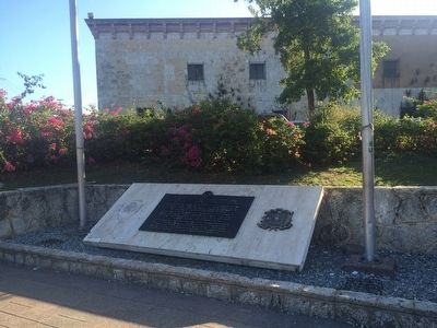
Location. 18° 28.584′ N, 69° 52.983′ W. Marker is in Ciudad Colonial, Distrito Nacional, in Santo Domingo. Marker can be reached from Calle Las Damas. The marker is on the left from the Royal Court building walking north towards the Residence of Diego Colón. Touch for map. Marker is in this post office area: Ciudad Colonial, Distrito Nacional 10212, Dominican Republic. Touch for directions.
Other nearby markers. At least 8 other markers are within walking distance of this marker. Palace of the Governors (within shouting distance of this marker); Nicolás de Ovando (within shouting distance of this marker); The Residence of Treasurer Cristóbal de Santa Clara (within shouting distance of this marker); 1505 Colonial House (about 90 meters away, measured in a direct line); Chapel of Our Lady of the Remedies (about 90 meters away); Plaza de los Contadores (about 90 meters away); Casa del Cordón (about 90 meters away); House of the Jesuits (about 90 meters away). Touch for a list and map of all markers in Ciudad Colonial.

Photographed By J. Makali Bruton, January 17, 2016
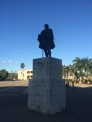
3. Statue of Nicolás Ovando nearby
This statue of Ovando (mentioned on the marker) reads: Frey Nicolas de Ovando (1451-1511), Gobernador de la isla Española, Comendador Mayor de la Orden de Alcantara, Fundador de la Nueva Ciudad de Santo Domingo
English translation:
Nicolás de Ovando (1451-1511), Governor of the island Hispaniola, Commander Major of the Order of Alcántara, Founder of the new city of Santo Domingo
English translation:
Nicolás de Ovando (1451-1511), Governor of the island Hispaniola, Commander Major of the Order of Alcántara, Founder of the new city of Santo Domingo
Credits. This page was last revised on July 28, 2023. It was originally submitted on March 4, 2016, by J. Makali Bruton of Accra, Ghana. This page has been viewed 432 times since then and 10 times this year. Photos: 1, 2, 3. submitted on March 4, 2016, by J. Makali Bruton of Accra, Ghana.

