Piney River in Nelson County, Virginia — The American South (Mid-Atlantic)
The Scale House
The Virginia Blue Ridge Railway Trail
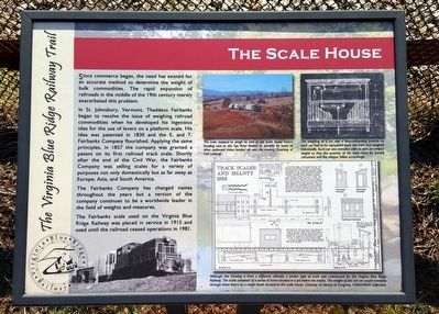
In St. Johnsbury, Vermont, Thaddeus Fairbanks began to resolve the issue of weighing railroad commodities when he developed his ingenious idea for the use of levers on a platform scale. His idea was patented in 1830 and the E. and T. Fairbanks Company flourished. Applying the same principles, in 1857 the company was granted a patent on its first railroad track scale. Shortly after the end of the Civil War, the Fairbanks Company was selling scales for a variety of purposes not only domestically but as far away as Europe, Asia, and South America.
The Fairbanks Company has changed names throughout the years but a version of the company continues to be a worldwide leader in the field of weights and measures.
The Fairbanks scale used on the Virginia Blue Ridge Railway was placed in service in 1915 and used until the railroad ceased operations in 1981.
(captions)
(top center) The train stopped to weigh its cars at the scale house before heading east to the Tye River Station no transfer its loads to other outbound trains headed all over the country. Courtesy of Carl Lathrop.
(top right) The weighing of a car was a time-consuming process as each car had to be uncoupled from the train and weighed individually. Each car was stenciled with is tare (or empty) weight so that the quantity of the load could be quickly calculated and the shipper billed accordingly.
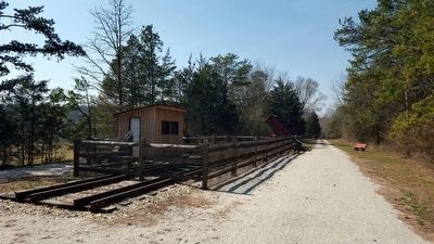
(bottom right) Although this drawing is from a different railroad, a similar type of scale was constructed for the Virginia Blue Ridge Railway. The scale consisted of a series of levers located in a pit below the tracks. The weight of the rail car would translate through these levers to a weigh beam located in the scale house. Courtesy of Library of Congress, HABS/HAER Collection.
Erected by Virginia Blue Ridge Railway Trail.
Topics. This historical marker is listed in these topic lists: Industry & Commerce • Railroads & Streetcars.
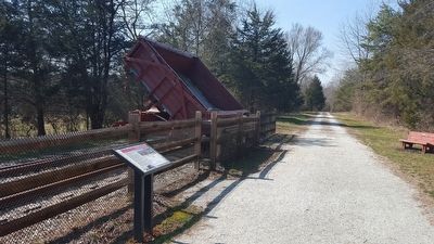
Location. 37° 39.081′ N, 78° 57.119′ W. Marker is in Piney River, Virginia, in Nelson County. Marker can be reached from Patrick Henry Highway (Virginia Route 151) 0.4 miles south of Firehouse Road (Virginia Route 675), on the left when traveling south. Located along the Virginia Blue Ridge Railway Trail. Touch for map. Marker is at or near this postal address: 3124 Patrick Henry Hwy, Piney River VA 22964, United States of America. Touch for directions.
Other nearby markers. At least 8 other markers are within 5 miles of this marker, measured as the crow flies. Action at Tye River (approx. 0.6 miles away); The Rivers (approx. 2.8 miles away); Cabellsville (approx. 3.8 miles away); The Reverend Robert Rose (approx. 3.9 miles away); Grave of Patrick Henry’s Mother (approx. 4 miles away); Jimmy Fortune (approx. 5 miles away); Earl Henry Hamner, Jr. (approx. 5 miles away); Oak Ridge Estate (approx. 5.1 miles away).
Also see . . . Virginia Blue Ridge Railway Trail. (Submitted on March 9, 2016.)
Credits. This page was last revised on June 16, 2016. It was originally submitted on March 9, 2016, by Bernard Fisher of Richmond, Virginia. This page has been viewed 477 times since then and 41 times this year. Photos: 1, 2, 3. submitted on March 9, 2016, by Bernard Fisher of Richmond, Virginia.


