Near Williamsport in Warren County, Indiana — The American Midwest (Great Lakes)
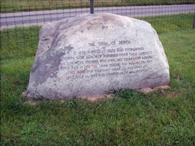
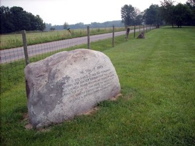
The Trail of Death
Topics and series. This historical marker is listed in these topic lists: Anthropology & Archaeology • Landmarks • Native Americans • Notable Events • Notable Places. In addition, it is included in the Potawatomi Trail of Death series list. A significant historical month for this entry is September 1892.
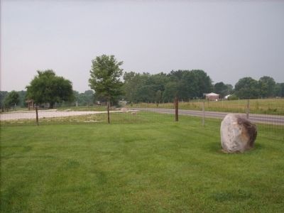
Location. 40° 20.286′ N, 87° 9.884′ W. Marker is near Williamsport, Indiana, in Warren County. Marker is on East Independence Road near North 800 East, on the right when traveling east. N. 800 E. is also known as 650 North due to converging of the two Counties of Warren and Fountain at Independence Road. Touch for map. Marker is in this post office area: Williamsport IN 47993, United States of America. Touch for directions.
Other nearby markers. At least 8 other markers are within 6 miles of this marker, measured as the crow flies. Zachariah Cicott (approx. 0.9 miles away); Davis Township - Maysville (approx. one mile away); a different marker also named Trail of Death (approx. 4.6 miles away); Ravine Park (approx. 5.1 miles away); Marshall M Milford Home (approx. 5.3 miles away); The Old Church (approx. 5.3 miles away); Hotel Attica (approx. 5.3 miles away); The Old Library (approx. 5.4 miles away).
Also see . . . Potawatomi Trail of Death. Association website (Submitted on August 5, 2008, by Al Wolf of Veedersburg, Indiana.)
Additional keywords. Zachariah Cicott
Credits. This page was last revised on December 29, 2020. It was originally submitted on July 19, 2008, by Al Wolf of Veedersburg, Indiana. This page has been viewed 1,968 times since then and 14 times this year. Photos: 1, 2, 3, 4. submitted on July 19, 2008, by Al Wolf of Veedersburg, Indiana. • Christopher Busta-Peck was the editor who published this page.


