Throckmorton in Throckmorton County, Texas — The American South (West South Central)
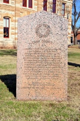
Camp Cooper, C.S.A.
A memorial to Texans who served the Confederacy
Erected 1963 by State of Texas. (Marker Number 658.)
Topics. This memorial is listed in these topic lists: War, US Civil • Wars, US Indian.
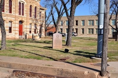
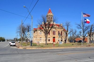
Location. 33° 10.729′ N, 99° 10.656′ W. Marker is in Throckmorton, Texas, in Throckmorton County. Memorial is at the intersection of N. Minter Avenue (U.S. 283) and W. Chesnut Street (U.S. 380), on the left when traveling north on N. Minter Avenue. Marker is located at the southeast corner of the grounds of the county courthouse. Touch for map. Marker is in this post office area: Throckmorton TX 76483, United States of America. Touch for directions.
Other nearby markers. At least 8 other markers are within 12 miles of this marker, measured as the crow flies. Throckmorton County Courthouse (a few steps from this marker); Throckmorton County Veterans Memorial (within shouting distance of this marker); Great Western Trail (within shouting distance of this marker); Throckmorton County Jail (approx. 0.2 miles away); Throckmorton County (approx. one mile away); a different marker also named Great Western Trail (approx. 2.7 miles away); Bush Knob Massacre (approx. 6 miles away); Site of the Principal Village of the Comanche Indian Reserve (approx. 11˝ miles away). Touch for a list and map of all markers in Throckmorton.
Also see . . .
1. Camp Cooper. From the Texas State Historical Association’s “Handbook of Texas Online”. (Submitted on March 27, 2016.)
2. Camp Cooper, Ft. Belknap and the Indian Reservations. From the Texas State Historical Association’s “Texas Almanac”. (Submitted on March 27, 2016.)
Credits. This page was last revised on June 16, 2016. It was originally submitted on March 27, 2016, by Duane Hall of Abilene, Texas. This page has been viewed 615 times since then and 33 times this year. Photos: 1, 2, 3. submitted on March 27, 2016, by Duane Hall of Abilene, Texas.


