St. Augustine in St. Johns County, Florida — The American South (South Atlantic)
Nuestra Señora de los Remedios
Our Lady of Remedies
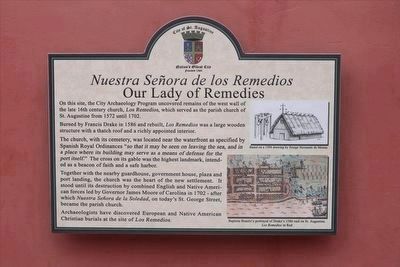
On this site, the City Archaeology Program uncovered remains of the west wall of the late 16th century church, Los Remedios, which served as the parish church of St. Augustine from 1572 until 1702.
Burned by Francis Drake in 1586 and rebuilt, Los Remedios was a large wooden structure with a thatch roof and a richly appointed interior.
The church, with its cemetery, was located near the waterfront as specified by Spanish Royal Ordinances "so that it may be seen on leaving the sea, and in a place where its building may serve as a means of defense for the port itself." The cross on its gable was the highest landmark, intended as a beacon of faith and a safe harbor.
Together with the nearby guardhouse, government house, plaza and port landing, the church was the heart of the new settlement. It stood until its destruction by combined English and Native American forces led by Governor James Moore of Carolina in 1702 - after which Nuestra Señora de la Soledad, on today's St. George Street, became the parish church.
Archaeologists have discovered European and Native American Christian burials at the site of Los Remedios.
Captions:
Based on a 1594 drawing by Ensign Hernando de Mestas.
Baptista Boazio’s portrayal of Drake’s 1586 raid on St. Augustine. Los Remedios in Red
Erected by City of St. Augustine.
Topics. This historical marker is listed in these topic lists: Cemeteries & Burial Sites • Churches & Religion. A significant historical year for this entry is 1572.
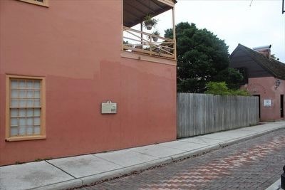
Location. 29° 53.526′ N, 81° 18.7′ W. Marker is in St. Augustine, Florida, in St. Johns County. Marker is at the intersection of Aviles Street and King Street (Business U.S. 1), on the left when traveling south on Aviles Street. Touch for map. Marker is at or near this postal address: 11 King St, Saint Augustine FL 32084, United States of America. Touch for directions.
Other nearby markers. At least 8 other markers are within walking distance of this marker. Florida (a few steps from this marker); St. Augustine Foot Soldiers (within shouting distance of this marker); 31 King Street (within shouting distance of this marker); The St. Augustine Foot Soldiers Monument (within shouting distance of this marker); Public Market Place (within shouting distance of this marker); Cast Iron Gun (within shouting distance of this marker); Public Well (within shouting distance of this marker); Slave Market (within shouting distance of this marker). Touch for a list and map of all markers in St. Augustine.
Credits. This page was last revised on January 2, 2019. It was originally submitted on March 28, 2016, by Tim Fillmon of Webster, Florida. This page has been viewed 486 times since then and 48 times this year. Photos: 1, 2. submitted on March 28, 2016, by Tim Fillmon of Webster, Florida. • Bernard Fisher was the editor who published this page.

