Dupont Circle in Northwest Washington in Washington, District of Columbia — The American Northeast (Mid-Atlantic)
Connecticut Ave. from Lafayette Square to Ashmead Place
Dupont Circle
— Diverse Visions | One Neighborhood —
Inscription.
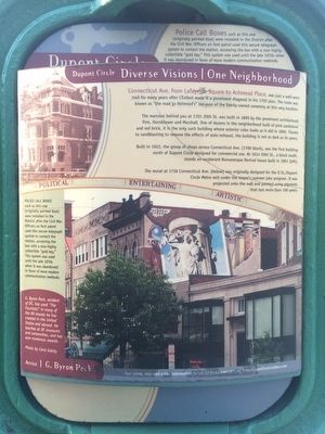
Connecticut Ave. from Lafayette Square to Ashmead Place was just a well-worn trail for many years, after L'Enfant made it a prominent diagonal in his 1792 plan. The route was known as "the road to Holmead's" because of the family-owned cemetery at this very location.
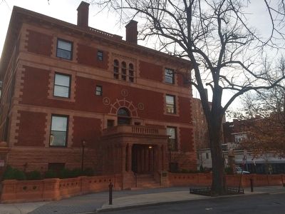
The mansion behind you at 1701 20th St. was built in 1890 by the prominent architectural firm, Hornblower and Marshall. One of dozens in the neighborhood built of pink sandstone and red brick, it is the only such building whose exterior color looks as it did in 1890. Thanks to sandblasting to remove the effects of auto exhaust, the building is not as dark as its peers.
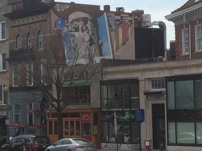
Built in 1922, the group of shops across Connecticut Ave. (1700 block), was the first building north of Dupont Circle designed for commercial use. At 1614 20th St., a block south, stands an exuberant Romanesque Revival house built in 1891 (left).
The mural at 1736 Connecticut Ave. (below) was originally designed for the Q St./Dupont Circle Metro exit under the mayor's summer jobs program. It was projected onto the wall and painted using pigments that last more than 100 years.
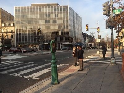
Police Call Boxes such as this one (originally painted blue) were installed in the District after the Civil War. Officers on foot patrol used this secure telegraph system to contact the station, accessing the box with a now highly collectible "gold key." This system was used until the late 1970s when it was abandoned in favor of more modern communication methods.
Police Call Box text repeated along marker side.
Artist G. Byron Peck
G. Byron Peck, resident of DC, has used "The Fountain" in many of the 80 murals he has created in the United States and abroad. He teaches at DC museums and universities, and has won numerous awards.
Photo by Carol Galaty
Erected by Cultural Tourism DC. (Marker Number 7.)
Topics and series. This historical marker is listed in these topic lists: Arts, Letters, Music • Industry & Commerce • Roads & Vehicles • Settlements & Settlers. In addition, it is included in the DC, Art on Call series list. A significant historical year for this entry is 1792.
Location. 38° 54.76′ N, 77° 2.684′ W. Marker is in Northwest Washington in Washington, District of Columbia. It is in Dupont Circle. Marker is at the intersection of R Street Northwest and 20th Street Northwest, on the right when traveling west on R Street Northwest. Touch for map. Marker is at or near this postal address: 1950 R Street Northwest, Washington DC 20009, United States of America. Touch for directions.
Other nearby markers. At least 8 other markers are within walking distance of this marker. Fraser Mansion (a few steps from this marker); Blanche K. Bruce and Josephine Beall Willson Bruce Residence
(about 300 feet away, measured in a direct line); From 1890 to 1910 (about 600 feet away); 2019 Q Street NW (about 600 feet away); Excerpt from Walt Whitman's "The Dresser" (1865 version) and "We Embrace" by E. Ethelbert Miller (about 600 feet away); Carl Lutz (about 700 feet away); Kossuth House (about 700 feet away); National Museum of American Jewish Military History Memorial Garden (about 700 feet away). Touch for a list and map of all markers in Northwest Washington.
Credits. This page was last revised on January 30, 2023. It was originally submitted on March 29, 2016, by J. Makali Bruton of Accra, Ghana. This page has been viewed 362 times since then and 15 times this year. Photos: 1, 2, 3, 4, 5. submitted on March 29, 2016, by J. Makali Bruton of Accra, Ghana.
