Leesburg in Loudoun County, Virginia — The American South (Mid-Atlantic)
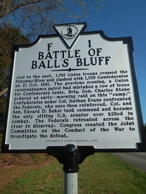
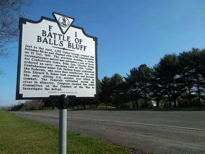
Battle of Ball's Bluff
Erected 2015 by Department of Historic Resources. (Marker Number F-1.)
Topics and series. This historical marker is listed in this topic list: War, US Civil. In addition, it is included in the Virginia Department of Historic Resources (DHR) series list. A significant historical date for this entry is October 21, 1861.
Location. 39° 7.613′ N, 77° 32.613′ W. Marker is in Leesburg, Virginia, in Loudoun County. Marker is at the intersection of Leesburg Bypass (U.S. 15) and Battlefield Parkway, on the right when traveling south on Leesburg Bypass. Touch for map. Marker is in this post office area: Leesburg VA 20176, United States of America. Touch for directions.
Other nearby markers. At least 8 other markers are within walking distance of this marker. A Divided America, A Divided Loudoun County (approx. ĺ mile away); The Battle of Ball's Bluff in Perspective (approx. ĺ mile away); Aftermath of Ballís Bluff (approx. ĺ mile away); a different marker also named Battle of Balls Bluff (approx. ĺ mile away); Additional Area Civil War Sites (approx. ĺ mile away); The Battle at Ballís Bluff (approx. ĺ mile away); Battle of Ball's Bluff - October 21, 1861 (approx. 0.8 miles away); a different marker also named The Battle of Ball's Bluff (approx. 0.8 miles away). Touch for a list and map of all markers in Leesburg.
Also see . . .
1. Old Marker at this Location. This marker replaced an older one at this location also titled “Battle of Ball's Bluff” (Submitted on March 29, 2016.)
2. Previous F-1 Marker was located nearby. (Submitted on September 28, 2019, by J. J. Prats of Powell, Ohio.)
Credits. This page was last revised on September 28, 2019. It was originally submitted on March 29, 2016, by T. Elizabeth Renich of Winchester, Virginia. This page has been viewed 493 times since then and 20 times this year. Photos: 1, 2. submitted on March 26, 2016, by T. Elizabeth Renich of Winchester, Virginia. • Bernard Fisher was the editor who published this page.

