Managua , Nicaragua — Central America
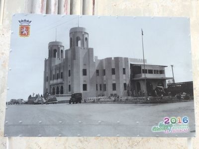
The Presidential House of Nicaragua
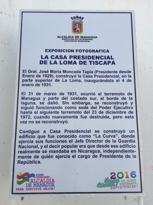
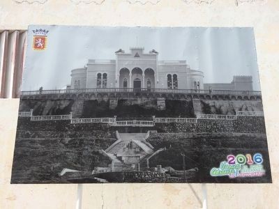
La Casa Presidencial de La Loma de Tiscapa
— Exposicion fotografica —
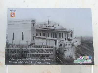
El 31 de marzo de 1931, ocurrió el terremoto de Managua y parte del costado sur, al borde de la laguna, se dañó. Sin embargo, se reconstruyó y siguió funcionando como sede del Poder Ejecutivo hasta el siguiente terremoto del 23 de diciembre de 1972, cuando nuevamente fue destruida, pero esta vez no se reconstruyó.
Contiguo a Casa Presidencial se construyó un edificio que fue conocido como “La Curva”, donde ejercía sus funciones el Jefe Director de la Guardia Nacional, y el decir popular era que desde ese edificio realmente se mandaba en Nicaragua, independientemente de quién ejercía el cargo de Presidente de la República.
English translation:
General José María Moncada Tapia (President since January 1929), built the Presidential House at the top of La Loma, inaugurating it on January 4, 1931.
On March 31, 1931, the Managua earthquake hit and the south side of the house, on the edge of the crater lake, was damaged. However, it was rebuilt and continued to operate as the seat of executive power until the next earthquake on December 23, 1972, when it was destroyed again, but this time it was not rebuilt.
Adjoining the Presidential House was a building that was known as "La Curva", where the Chief Director of the National Guard had his headquarters. A popular saying from the time was that it was this building that actually governed in Nicaragua, regardless of who held the position of President of the Republic.
Erected 2016 by Alcadía de Managua, Dirección de Patrimonio Histórico Municipal.
Topics. This historical marker is listed in these topic lists: Disasters • Government & Politics • Man-Made Features. A significant historical month for this entry is January 1929.
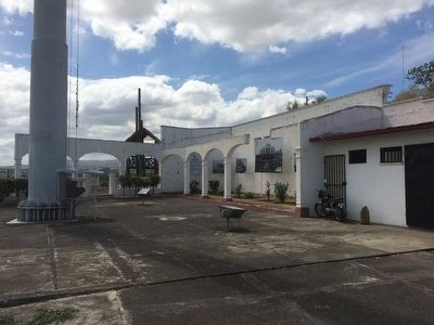
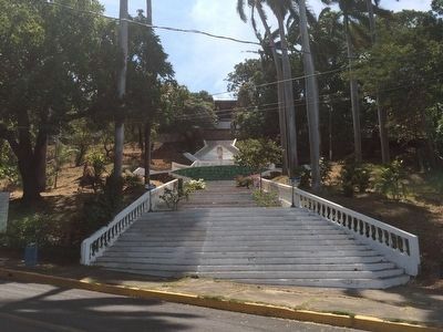
Location. 12° 8.489′ N, 86° 16.385′ W. Marker is in Managua. Marker is on 9a Calle Suroeste, on the left when traveling west. This marker is attached to the ruins of the Presidential House at Lomas de Tiscapa. Touch for map. Marker is in this post office area: Managua 11118, Nicaragua. Touch for directions.
Other nearby markers. At least 8 other markers are within 3 kilometers of this marker, measured as the crow flies. Dr. Pedro Joaquin Chamorro Cardenal (within shouting distance of this marker); Assassination of General Augusto C. Sandino (within shouting distance of this marker); Monument to the Heroes of April 4, 1954 (about 90 meters away, measured in a direct line); Martyrs of the National Workers Front (approx. 1.4 kilometers away); Fulgencio Vega (approx. 1.6 kilometers away); Tomb of Three Founders of the Sandinistas
(approx. 1.7 kilometers away); Francisco Morazán (approx. 1.7 kilometers away); Workers Fallen in the Sandinista Revolution (approx. 1.9 kilometers away). Touch for a list and map of all markers in Managua.
Credits. This page was last revised on February 12, 2022. It was originally submitted on April 1, 2016, by J. Makali Bruton of Accra, Ghana. This page has been viewed 483 times since then and 38 times this year. Photos: 1, 2, 3, 4, 5, 6. submitted on April 1, 2016, by J. Makali Bruton of Accra, Ghana.
