Near Kerrville in Kerr County, Texas — The American South (West South Central)
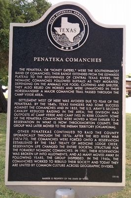
Penateka Comanches
Settlement west of here was avoided due to fear of the Penatekas. By the 1840s, Texas Rangers had some success against the Comanches and in 1855, the U.S. Army’s Second Cavalry reduced raiding in the area; the division had outposts at Camp Verde and Camp Ives in Kerr county. Some of the Penateka Comanches were moved a year earlier to a reservation in what is now Throckmorton County; the group was later moved to the Indian Territory (Oklahoma).
Other Penatekas continued to raid the county sporadically through the 1870s. After the Red River War (1874-75), the Comanches were forced onto a reservation established by the 1867 Treaty of Medicine Lodge Creek. Reservation life changed the entire societal structure for the formerly nomadic Comanches. In 1901, their reservation was broken up into allotments, and as many moved away in following years, the group dispersed. In the 1960s, the Comanches worked to rebuild their society and today they are united by common culture across geographic divides.
Erected 2010 by Texas Historical Commission. (Marker Number 16257.)
Topics. This historical marker is listed in these topic lists: Native Americans • Wars, US Indian. A significant historical year for this entry is 1855.
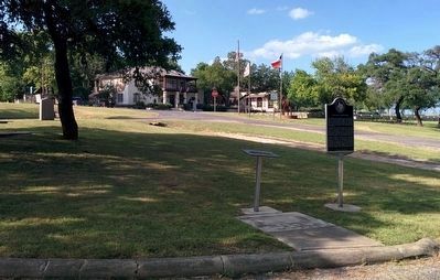
Location. 29° 53.602′ N, 99° 6.302′ W. Marker is near Kerrville, Texas, in Kerr County. Marker can be reached from the intersection of Bandera Highway (State Highway 173) and East Verde Creek Road, on the left when traveling south. Marker is in picnic area of Camp Verde Park. Touch for map. Marker is at or near this postal address: 285 E Verde Cr Rd, Center Point TX 78010, United States of America. Touch for directions.
Other nearby markers. At least 8 other markers are within 5 miles of this marker, measured as the crow flies. One Mile to Ruins of Camp Verde (a few steps from this marker); Camps Verde C.S.A. (a few steps from this marker); Camp Verde General Store and Post Office (within shouting distance of this marker); Site of Camp Verde (approx. 0.9 miles away); Bandera Pass (approx. 2.4 miles away); a different marker also named Bandera Pass (approx. 2.4 miles away); Center Point Cemetery (approx. 5 miles away); N.O. Reynolds (approx. 5 miles away).
Also see . . . Comanche Indian article in Handbook of Texas Online. (Submitted on April 1, 2016, by Gregory Walker of La Grange, Texas.)
Credits. This page was last revised on June 16, 2016. It was originally submitted on April 1, 2016, by Gregory Walker of La Grange, Texas. This page has been viewed 7,494 times since then and 397 times this year. Photos: 1, 2. submitted on April 1, 2016, by Gregory Walker of La Grange, Texas. • Bernard Fisher was the editor who published this page.

