Booker in Lipscomb County, Texas — The American South (West South Central)
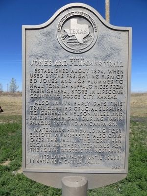
Route of Jones and Plummer Trail
Also, in its early days, this trail carried crucial supplies to Generals Nelson Miles and Philip Sheridan during their famous 1874 Indian campaign.
Materials for building Fort Elliott, at Mobeetie, also came over the trail. The fort then became southern terminus for the route; Dodge City, northern.
In its later years (until 1885), it became a cattle trail.
Erected 1968 by State Historical Survey Committee. (Marker Number 4368.)
Topics. This historical marker is listed in this topic list: Roads & Vehicles. A significant historical year for this entry is 1874.
Location. 36° 27.338′ N, 100° 31.851′ W. Marker is in Booker, Texas, in Lipscomb County. Marker is at the intersection of State Highway 15 and State Highway 23, on the right when traveling west on State Highway 15. Marker is on the northeast corner. Touch for map. Marker is in this post office area: Booker TX 79005, United States of America. Touch for directions.
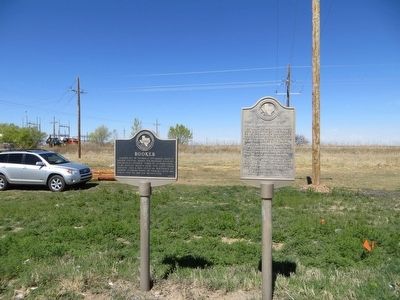
Other nearby markers. At least 6 other markers are within 11 miles of this marker, measured as the crow flies. Booker (here, next to this marker); View Point Cemetery (approx. 0.2 miles away); Heart Cemetery (approx. 1˝ miles away); No Man's Land (approx. 3.2 miles away in Oklahoma); Kiowa Cemetery (approx. 4.8 miles away); Darrouzett Cemetery (approx. 10.6 miles away).
Also see . . . Jones and Plummer Trail. During the peak freight years of 1880 to 1886 the Jones and Plummer trail provided a crucial conduit for the materials needed to sustain such important projects as the building of Fort Elliott. Troops in the field, hunters, ranchers, homesteaders, and towns also depended on the goods that passed along the Jones and Plummer Trail. At times, the sheer volume of freight was remarkable. (Submitted on April 2, 2016, by Bill Kirchner of Tucson, Arizona.)
Credits. This page was last revised on June 16, 2016. It was originally submitted on April 2, 2016, by Bill Kirchner of Tucson, Arizona. This page has been viewed 464 times since then and 33 times this year. Photos: 1, 2. submitted on April 2, 2016, by Bill Kirchner of Tucson, Arizona.

