Patterson in St. Mary Parish, Louisiana — The American South (West South Central)
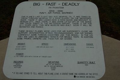
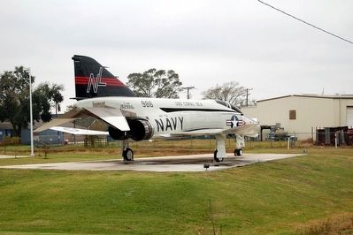
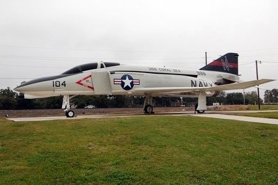
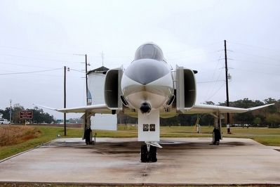
Big - Fast - Deadly
F4 Phantom
— 1958-1996
(Navy, Air Force, Marines) —
These deadly planes were used for air superiority, close air support, interception attack, reconnaissance and air shows. Currently some foreign countries use this model. In the U.S. they are used for unmanned targets for missile tests. In addition, some private owners use them for air shows.
Weight
30,320 empty
62,000 loaded
Speed
1,485 MPH @ 4800 feet
Dimensions
62' 11" long
38' 11" wide
16'5" high @ tail
Range
1300 miles
Power
2 J-79 Turbo Jets with 17,900# of thrust each
Records
Speed
Endurance
Altitude
Weapons
Air to air Missiles
Air to ground missiles
Bombs
Guns
Quantity Built
5195
**If you have stories to tell about this plane, leave a contact name and address at the office.
Topics. This historical marker is listed in these topic lists: Air & Space • War, 1st Iraq & Desert Storm • War, Cold • War, Vietnam.
Location. 29° 40.688′ N, 91° 17.632′ W. Marker is in Patterson, Louisiana, in St. Mary Parish. Marker can be reached from U.S. 90 west of Silo Road, on the left when traveling west. Located in front of the Wedell-Williams Aviation and Cypress Sawmill Museum. Touch for map. Marker is at or near this postal address: 118 Cotten Road, Patterson LA 70392, United States of America. Touch for directions.
Other nearby markers. At least 8 other markers are within 6 miles of this marker, measured as the crow flies. Cypress Swamps (within shouting distance of this marker); Williams Memorial Airport (approx. 3.7 miles away); Battle Of Bisland (approx. 4.6 miles away); Twin City Gospel Temple (approx. 4.7 miles away); Southwest Reef Lighthouse (approx. 4.8 miles away); Morgan City Floodwalls (approx. 5.2 miles away); Atchafalaya River (approx. 5.2 miles away); a different marker also named Atchafalaya River (approx. 5.2 miles away). Touch for a list and map of all markers in Patterson.
Credits. This page was last revised on June 17, 2022. It was originally submitted on April 3, 2016. This page has been viewed 356 times since then and 9 times this year. Photos: 1, 2, 3, 4. submitted on April 3, 2016. • Bernard Fisher was the editor who published this page.


