Antioch in Contra Costa County, California — The American West (Pacific Coastal)
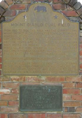
Mount Diablo Coal Field
Inscription.
From 1860 to 1906, this area was the largest coal mining district in California. Five towns (Nortonville, Somersville, Stewartville, Judsonville and West Hartley) grew up around twelve major mines. Today the towns are gone. The buildings having been moved to nearby communities. After the mines closed, mine openings, tailings, railroad beds and a pioneer cemetery are being preserved by the East Bay Regional Park District.
Erected 1980 by California Department of Parks and Recreation in cooperation with the East Bay Regional Park District and E Clampus Vitus, Joaquin Murrieta Chapter No. 13. (Marker Number 932.)
Topics and series. This historical marker is listed in this topic list: Natural Resources. In addition, it is included in the California Historical Landmarks, and the E Clampus Vitus series lists. A significant historical year for this entry is 1860.
Location. 37° 57.488′ N, 121° 51.793′ W. Marker is in Antioch, California, in Contra Costa County. Marker is on Somersville Road, in the median. Touch for map. Marker is at or near this postal address: 5175 Somersville Road, Antioch CA 94509, United States of America. Touch for directions.
Other nearby markers. At least 8 other markers are within walking distance of this marker. Black Diamond Mines Regional Preserve (a few steps from this marker); Independent Mine (within shouting distance of this marker); Somersville Townsite (within shouting distance of this marker); Greathouse Portal (approx. ¼ mile away); a different marker also named Mount Diablo Coal Field (approx. ¼ mile away); Eureka Slope (approx. ¼ mile away); Rose Hill Cemetery (approx. 0.4 miles away); David Watts, Theophilus Watts and Thomas D. James (approx. 0.4 miles away). Touch for a list and map of all markers in Antioch.
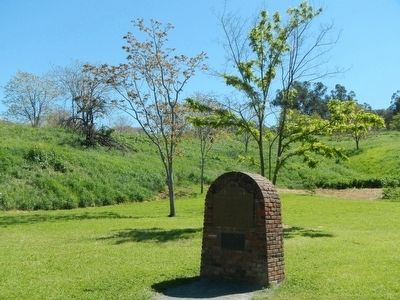
More about this marker. This marker is located at the southern end of Somersville Road in Black Diamond Regional Park.
Also see . . . Coal Mining -- Clayton Historical Society. It was the discovery in 1858 of a coal outcrop by W.C. Israel six miles south of Antioch and in 1859 of the Black Diamond Vein of coal by Francis Somers and James T. Cruikshank that created a furor. Coal found so close to San Francisco was vital to the growth of the California economy. It provided a cheap readily available source of the energy needed to fuel the foundries, mills, ferries, steamers and developing industries. (Submitted on April 5, 2016, by Barry Swackhamer of Brentwood, California.)
Credits. This page was last revised on September 12, 2019. It was originally submitted on April 4, 2016, by Barry Swackhamer of Brentwood, California. This page has been viewed 477 times since then and 36 times this year. Last updated on September 12, 2019, by Craig Baker of Sylmar, California. Photos: 1, 2. submitted on April 4, 2016, by Barry Swackhamer of Brentwood, California. • Andrew Ruppenstein was the editor who published this page.

