Walnut Creek in Contra Costa County, California — The American West (Pacific Coastal)
Mt Diablo State Park
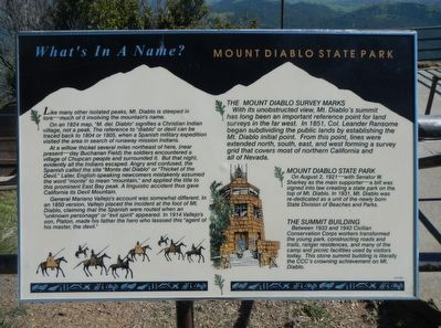
What's In A Name?
On a 1824 map, "M. del Diablo" signifies a Christian Indian village, not a peak. The reference to "diablo" or devil can be traced back to 1804 or 1805, when a Spanish military expedition visited the area in search of runaway missions Indians.
At a willow thicket several miles northeast of here, (near present-day Buchanan Field) the soldiers encountered a village of Chupcan people and surrounded it. But that night, evidently all the Indians escaped. Angry and confused, the Spanish called the site "Monte del Diablo" or Thicket of the Devil." Later English-speaking newcomers mistakenly applied the title to this prominent East Bay peak. A linguistic accident thus gave California its Devil Mountain.
General Mariano Vallejo's account was somewhat different. In an 1850 version, Vallejo placed the incident at the foot of Mt. Diablo, claiming that the Spanish were routed when an "unknown personage" or "evil spirit" appeared. In 1914 Vallejo's son, Platon, made his father the hero who lassoed this "agent of his master, the devil."
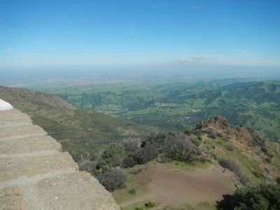
With its unobstructed view, Mt. Diablo's summit has long been an important reference point for land surveys in the far west. In 1851, Col. Leander Ransome began subdividing the public lands by establishing the Mt. Diablo initial point. From this point, lines were extended north, south, east and west forming a survey grid that covers most of northern California and all of Nevada.
On August 2, 1921 - with Senator W. Starkey as the main supporter - a bill was signed into law creating a state park on top of Mt. Diablo. In 1931, Mt. Diablo was re-dedicated as a unit of the newly born State Division of Beaches and Parks.
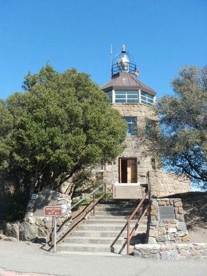
Between 1933 and 1942 Civilian Conservation Corps workers transformed the young park constructing roads and trails, ranger residences, and many of the camp and picnic facilities used by visitors today. This stone summit building is literally the CCC's crowning achievement on Mt. Diablo.
Erected by Mt Diablo State Park.
Topics and series. This historical marker is listed in this topic list: Landmarks. In addition, it is included in the Civilian Conservation Corps (CCC) series list. A significant historical date for this entry is August 2, 1921.
Location. 37° 52.895′ N, 121° 54.865′ W. Marker is in Walnut Creek, California, in Contra Costa County. Marker is on Summit Road, on the left when traveling east. Touch for map. Marker is in this post office area: Walnut Creek CA 94598, United States of America. Touch for directions.
Other nearby markers. At least 8 other markers are within 3 miles of this marker, measured as the crow flies. Mount Diablo (a few steps from this marker); Mount Diablo Beacon: (within shouting distance of this marker); What Are Those Towers For? (approx. ¼ mile away); Mount Diablo State Park (approx. ¼ mile away); Turritella Snail Bed (approx. 2.2 miles away); Sentinel Rock Overlook (approx. 2.3 miles away); Indian Grinding Holes (approx. 2.4 miles away); Blackhawk Ranch Quarry (approx. 2.4 miles away). Touch for a list and map of all markers in Walnut Creek.
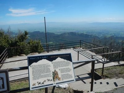
More about this marker. This marker is in the parking lot of Mt. Diablo Summit Museum in Mt. Diablo State Park.
Also see . . . Mount Diablo -- Wikipedia. It is an isolated upthrust peak of 3,849 feet (1,173 m), visible from most of the San Francisco Bay Area. Mount Diablo appears from many angles to be a double pyramid and has many subsidiary peaks, the largest and closest of which is the other half of the double pyramid, North Peak, nearly as high in elevation at 3,557 feet (1,084 m) and about a mile northeast of the main summit. (Submitted on April 5, 2016, by Barry Swackhamer of Brentwood, California.)
Photographed By Barry Swackhamer, April 1, 2016
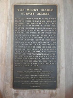
4. The Mount Diablo Survey Marks
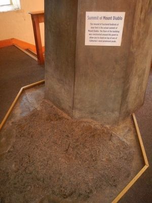
With its unobstructed view, Mount Diablo's summit has long been an important reference point for land surveys in the far west. In 1851, Col. Leander Ransom began subdividing the public lands by establishing the Mount Diablo Initial Point. From this point, lines were extended north, south east and west forming a survey grid that covers most of Northern California and all of Nevada. This point is marked by an rectangular depression in the exposed bedrock, three feet north east from the center of this pillar. In 1852, R.D. Cutts of the Coast Survey established a different survey mark from which he began mapping the State's waterways and surrounding topography. This point is marked by a copper bolt inside the base of this pillar.
Plaque Donated By:
Northern and Southern California Sections of the American Congress on Surveying and Mapping
Mount Diablo Surveyors Historical Society
East Bay, San Mateo/Santa Clara, Monterey Bay Chapters of the California Land Surveyors Association
Northern California Surveyors Joint Apprenticeship Committee
Kearney Pattern Works and Foundry
Placed in 1993
Credits. This page was last revised on June 16, 2016. It was originally submitted on April 5, 2016, by Barry Swackhamer of Brentwood, California. This page has been viewed 706 times since then and 48 times this year. Photos: 1, 2, 3, 4, 5, 6. submitted on April 5, 2016, by Barry Swackhamer of Brentwood, California.
