Glazier in Hemphill County, Texas — The American South (West South Central)
Glazier Cemetery
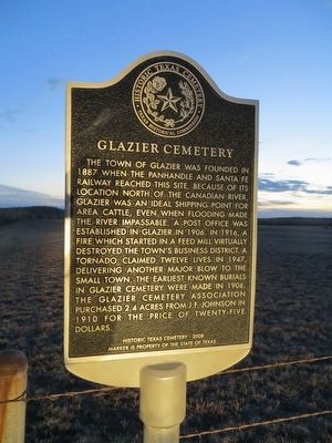
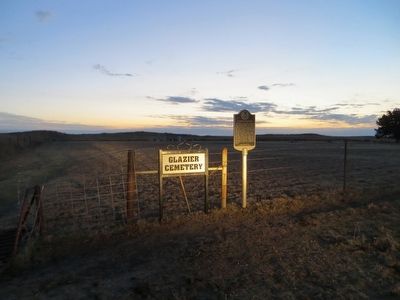
The town of Glazier was founded in 1887 when the Panhandle and Santa Fe Railway reached this site. Because of its location north of the Canadian River, Glazier was an ideal shipping point for area cattle, even when flooding made the river impassable. A post office was established in Glazier in 1906. In 1916, a fire which started in a feed mill virtually destroyed the town's business district. A tornado claimed twelve lives in 1947, delivering another major blow to the small town. The earliest known burials in Glazier Cemetery were made in 1906. The Glazier Cemetery Association purchased 2.4 acres from J.F. Johnson in 1910 for the price of twenty-five dollars.
Historic Texas Cemetery - 2008
Marker is property of the State of Texas
Erected 2008 by Texas Historical Commission. (Marker Number 15854.)
Topics. This historical marker is listed in this topic list: Cemeteries & Burial Sites. A significant historical year for this entry is 1887.
Location. 36° 1.166′ N, 100° 15.814′ W. Marker is in Glazier, Texas, in Hemphill County. Marker can be reached from U.S. 60, 0.1 miles east of Texas Highway 305. Marker is on dirt road 0.5 miles north of US-60. Touch for map. Marker is in this post office area: Canadian TX 79014, United States of America. Touch for directions.
Other nearby markers. At least 8 other markers are within 10 miles of this marker , measured as the crow flies. Anvil Park Ranch (approx. 7.3 miles away); Former Site of Hogtown (approx. 7.3 miles away); Gene Howe Wildlife Management Area (approx. 7˝ miles away); Canadian River Wagon Bridge (approx. 8.3 miles away); Quanah Parker Trail (approx. 9.2 miles away); Canadian River Trails (approx. 9.2 miles away); Hemphill County (approx. 9.2 miles away); Robert R. Young (approx. 9.2 miles away).
Credits. This page was last revised on August 2, 2020. It was originally submitted on April 5, 2016, by Bill Kirchner of Tucson, Arizona. This page has been viewed 390 times since then and 18 times this year. Photos: 1, 2, 3. submitted on April 5, 2016, by Bill Kirchner of Tucson, Arizona. 4. submitted on August 2, 2020, by Allen Lowrey of Amarillo, Texas.


