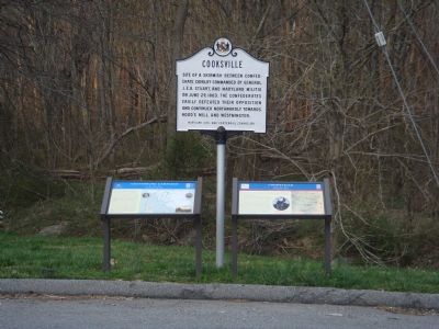
Near Cooksville in Howard County, Maryland — The American Northeast (Mid-Atlantic)
Cooksville
Saving the Guns
— Gettysburg Campaign —
When Confederate Gen. J.E.B. Stuart led his cavalry division north across the Potomac River into Maryland in June 1863, about 400 Federals and civilians were captured and then paroled in Brookeville. At the same time, Confederate Gen. Fitzhugh Lee’s brigade continued its march north toward Hood’s Mill.
Near Cooksville, meanwhile, Capt. R.E. Duvall’s Co. A, Purnell Legion Md. Cavalry, had bivouacked on the National Road with two ordnance rifles of Capt. W.D. Rank’s Battery H, 3rd Pa. Artillery. Duvall was escorting the guns to Relay in Baltimore County, where they were to be used in the defense of the Thomas Viaduct on the Baltimore and Ohio Railroad.
When Stuart’s advance drove in the Union pickets before dawn on June 29, Duvall sent Sgt. Andrew Duncan and Pvt. Jonathan Norris back to Frederick to warn Gen. George G. Meade of the Confederate presence, then beat a hasty retreat under cover of darkness. He lost some camp equipment and four horses but saved his men and Rank’s guns. Near Poplar Springs he encountered Col. John B. Mclntosh’s cavalry brigade, which was hunting for Stuart and offered protection. When Duvall’s company and the two guns did not reach Relay as expected, area commander Gen. Robert Schenck reported them captured. It was two days before he learned their true status.
Topics. This historical marker is listed in this topic list: War, US Civil. A significant historical month for this entry is June 1863.
Location. 39° 19.258′ N, 77° 1.146′ W. Marker is near Cooksville, Maryland, in Howard County. Marker is at the intersection of Roxbury Mills Road (Maryland Route 97) and Old Frederick Road (Maryland Route 144), on the right when traveling north on Roxbury Mills Road. It is in the Park-And-Ride lot at I-70 Exit 76. Touch for map. Marker is in this post office area: Cooksville MD 21723, United States of America. Touch for directions.
Other nearby markers. At least 10 other markers are within 4 miles of this marker, measured as the crow flies. A different marker also named Cooksville (here, next to this marker); Gettysburg Campaign (here, next to this marker); Roberts Inn (within shouting distance of this marker); Simpson & Mount Gregory United Methodist Churches (approx. 0.9 miles away); Mount Gregory United Methodist Church Bell (approx. 0.9 miles away); Cooksville High School (approx. 0.9 miles away); Dr. Charles Alexander Warfield (approx. 1.3 miles away); New Lisbon (approx. 2.8 miles away); Moving Goods on the National Road (approx. 3.1 miles away); The Historic Sykesville Colored Schoolhouse (approx. 3.8 miles away). Touch for a list and map of all markers in Cooksville.
Credits. This page was last revised on November 29, 2021. It was originally submitted on April 9, 2007, by J. J. Prats of Powell, Ohio. This page has been viewed 2,611 times since then and 30 times this year. Photos: 1, 2. submitted on April 9, 2007, by J. J. Prats of Powell, Ohio.

