La Paz Centro, León, Nicaragua — Central America
"The Fortress"
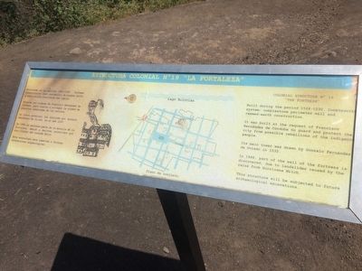
Colonial Structure No 19
— Estructura Colonial No 19 "La Fortaleza" —
Edificada en el periodo de 1524-1530. Sistema constructivo: muro perimetal de piedra bola y edificación construida con tapial.
Erigida por órdenes de Francisco Hernández de Córdoba, para vigilar y proteger la ciudad de posibles rebeliones de los nativos.
Su torre principal fue dibujada por Gonzalo Fernández de Oviedo, en el año 1532.
En 1998 se descubre parte de la muralla de la Fortaleza, debido a deslaves producidos por las lluvias de huracán Mitch.
Esta estructura será sometida a futuras excavaciones arqueológicas.
Caption: Plano de conjunto
English:
Colonial Structure No 19
"The Fortress"
Built during the period 1524-1530. Construction system: cobblestone perimeter wall and rammed-earth construction.
It was built at the request of Francisco Hernández de Córdoba to guard and protect the city from possible rebellions of the indigenous people.
Its main tower was drawn by Gonzalo Fernández de Oviedo in 1532.
In 1998, part of the wall of the fortress is discovered, due to landslides caused by the rains from Hurricane Mitch.
This structure will be subjected to future archaeological excavations.
Caption: Site map
Topics. This historical marker is listed in these topic lists: Anthropology & Archaeology • Colonial Era • Forts and Castles • Man-Made Features. A significant historical year for this entry is 1532.
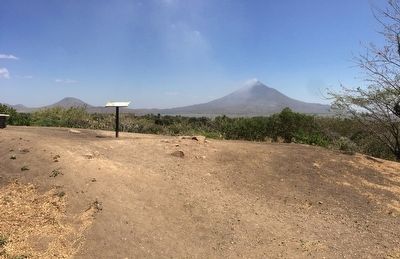
Location. 12° 24.015′ N, 86° 36.948′ W. Marker is in La Paz Centro, León. This marker is at the Viejo León Archaeological Site, to the south of the Central Park. Touch for map. Touch for directions.
Other nearby markers. At least 8 other markers are within walking distance of this marker. "The House of Martín" (about 120 meters away, measured in a direct line); “The House of Ana Jiménez” (about 150 meters away); "The House of Hernando de Soto and Hernán Ponce de León" (about 180 meters away); “The Saint Mary of Graces Cathedral” (about 180 meters away); "The Royal Road" (about 180 meters away); "The Town Square" (about 210 meters away); "Unidentified" Colonial Structure No 11 (about 240 meters away); “The Palace of Governor Rodrigo de Contreras” (approx. 0.2 kilometers away). Touch for a list and map of all markers in La Paz Centro.
Credits. This page was last revised on August 12, 2018. It was originally submitted on April 15, 2016, by J. Makali Bruton of Accra, Ghana. This page has been viewed 282 times since then and 6 times this year. Photos: 1, 2. submitted on April 15, 2016, by J. Makali Bruton of Accra, Ghana.

