Suchitoto, Cuscatlán, El Salvador — Central America (West Coast)
Streets of Ciudad Vieja
Calles de Ciudad Vieja
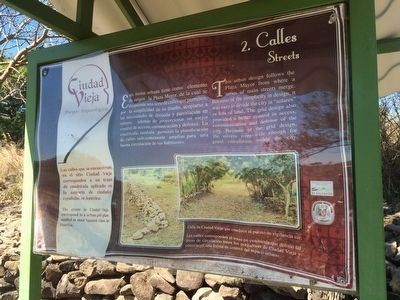
Las calles que se encuentran en el sitio Ciudad Vieja corresponden a un trazo de cuadrícula aplicado en la mayoria de ciudades españolas en América.
Pie de dibujos: Calle de Ciudad Vieja que conduce al puesto de vigilancia sur.
Las calles corresponden al trazo en cuadrícula que definió las áreas de circulación entre los pobladores de Ciudad Vieja y constituyó una forma de control del espacio urbano.
This urban design follows the Plaza Mayor from where a series of main streets merge. Because of the simplicity in design, it was easy to divide the city in "solares" or lots of land. The grid design also provided a better control in access, communication and defense of the city. Because of the grid design, the streets were wide enough for good circulation inside the city.
The streets in Ciudad Vieja correspond to a urban grid plan applied in most Spanish cities in America.
Captions:
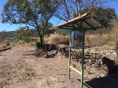
A street of Ciudad Vieja that leads to the southern surveillance post.
The streets correspond to a chessboard pattern that defined the main areas of circulation for the inhabitants of Ciudad Vieja and constituted a form of control over the urban environment. (Marker Number 2.)
Topics. This historical marker is listed in these topic lists: Anthropology & Archaeology • Colonial Era • Man-Made Features.
Location. 13° 51.531′ N, 89° 1.943′ W. Marker is in Suchitoto, Cuscatlán. The marker is at the Ciudad Vieja Archaeological Site, near Suchitoto, El Salvador. Touch for map. Marker is in this post office area: Suchitoto, Cuscatlán 01400, El Salvador. Touch for directions.
Other nearby markers. At least 8 other markers are within 10 kilometers of this marker, measured as the crow flies. Church Platform (about 90 meters away, measured in a direct line); Structure 3D2 (about 90 meters away); Structure 4D1 (about 120 meters away); Ciudad Vieja Archaeological Site (about 120 meters away); Structure 4E1 or Cabildo (about 150 meters away); Structure 1D1 or Southern Surveillance Point (about 210 meters away); Historia de / History of Suchitoto (approx. 8.7 kilometers away); The Church of Santa Lucía (approx. 8.7 kilometers away). Touch for a list and map of all markers in Suchitoto.
Credits. This page was last revised on July 28, 2019. It was originally submitted on April 17, 2016, by J. Makali Bruton of Accra, Ghana. This page has been viewed 253 times since then and 4 times this year. Photos: 1, 2. submitted on April 17, 2016, by J. Makali Bruton of Accra, Ghana.

