Berliner Innenstadt in Mitte, Berlin, Germany — Northeast German Plain (The European Plain)
Remains of the Berlin Wall
Überreste der Berliner Mauer
(English)
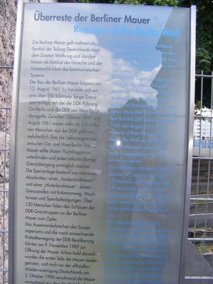
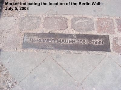
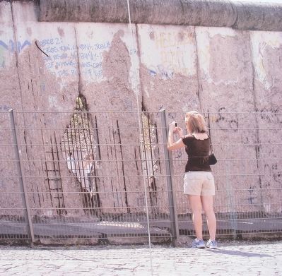
Construction began on August 13, 1961, on the orders of the GDR leadership. It formed a 150 kilometer long barrier sealing off East Berlin and East Germany from West Berlin. More than 2.6 million people had fled the GDR between October 1949 and August 1961, the big majority of them through West Berlin. The Wall was designed to halt this stream of refugees and make it impossible to cross the border unchecked.
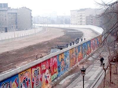
The installation consisted of several sections: an “anterior wall” and a “hinderland wall”, a border strip with service road watch towers and barrier fortifications. Over 150 people were shot down by GDR border patrols while attempting to cross it.
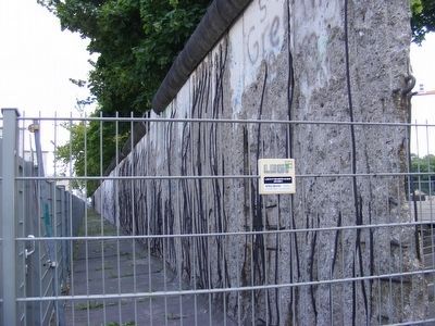
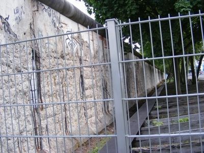
The impending collapse of the Soviet empire and the rapid growth of the GDR protest movement led to opening of the Wall on November 9, 1989. Soon afterwards the first sections of the barrier were torn down. Even before the official reunification of Germany on October 3, 1990, the Wall had largely disappeared from the Berlin cityscape.
Der Bau der Berliner Mauer begann am 13 August 1961. Es handelte sich am eine über 150 Kilometer lange Grenz sperranlage, mit der die DDR-Führung Ost-Berlin und die DDR von West-Berlin abriegelte. Zwischen Oktober 1949 und August 1961 waren mehr als 2,6 Millio nen Menschen aus der DDR geflohen, mehrheitlich über die Sektorengrenzen zwischen Ost- und West-Berlin. Die Mauer solite diesen Flüchtlingsstrom unterbinden und jeden unkontrollierten Grenzübergang unmöglich machen. Die Sperranlage bestand aus mehreren Abschnitten: einer „Vorderlandmauer" und einer „Hinterlandmauer", einem Grenzstreifen mit Kolonnenweg, Wach türmen und Sperrbefestigungen. Über 150 Menschen fielen den Schüssen der DDR-Grenztruppen an der Berliner Mauer zum Opfer.
Das Auseinanderbrechen des Sowjet imperiums und die rasch anwachsende Protestbewegung der DDR-Bevölkerung führten am 9 November 1989 zur Öffnung der Mauer. Schon bald danach wurden die ersten Teile der Mauer nieder gerissen, und noch vor der offiziellen Wiedervereinigung Deutschlands am 3 Oktober 1990 verschwand die Mauer ...
Topics and series. This
memorial is listed in these topic lists: Government & Politics • War, Cold. In addition, it is included in the Berlin Wall series list. A significant historical date for this entry is August 13, 1961.
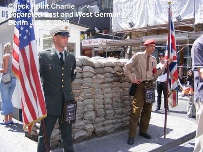
Location. 52° 30.427′ N, 13° 22.961′ E. Marker is in Berliner Innenstadt, Berlin, in Mitte. Memorial is on Niederkirchnerstraisse. The marker is near Check Point Charlie. Touch for map. Marker is in this post office area: Berliner Innenstadt BE 10117, Germany. Touch for directions.
Other nearby markers. At least 8 other markers are within walking distance of this marker. Baudenkmal Berliner Mauer (a few steps from this marker); Topography of Terror (within shouting distance of this marker); a different marker also named Baudenkmal Berliner Mauer (about 180 meters away, measured in a direct line); Checkpoint Charlie Site (approx. half a kilometer away); The Legend of Hitler’s Bunker (approx. 0.6 kilometers away); Pariser Platz (approx. 1.1 kilometers away); Soviet War Memorial (approx. 1.3 kilometers away); Max Planck (approx. 1.4 kilometers away). Touch for a list and map of all markers in Berliner Innenstadt.
Also see . . .
1. Wikipedia entry for The Berlin Wall. Excerpt:
At midnight, the police and units of the East German army began to close the border and, by Sunday morning, 13 August, the border with West Berlin was closed. East German troops and workers had begun to tear up streets running alongside the border to make them impassable to most vehicles and to install barbed wire entanglements and fences along the 156 kilometres (97 mi) around the three western sectors, and the 43 kilometres (27 mi) that divided West and East Berlin. The date of 13 August became commonly referred to as Barbed Wire Sunday in Germany.(Submitted on August 9, 2020.)
2. Wikipedia Entry for Iron Curtain. Excerpt:
The Iron Curtain was initially a non-physical boundary dividing Europe into two separate areas from the end of World War II in 1945 until the end of the Cold War in 1991. The term symbolizes the efforts by the Soviet Union (USSR) to block itself and its satellite states from open contact with the West and its allied states. On the east side of the Iron Curtain were the countries that were connected to or influenced by the Soviet Union, while on the west side were the countries that were NATO members or nominally neutral. Separate international economic and military alliances were developed on each side of the Iron Curtain. It later became a term for the 4,300-mile-long physical barrier of fences, walls, minefields, and watchtowers that divided the "east" and "west". The Berlin Wall was also part of this physical barrier.(Submitted on August 9, 2020.)
Credits. This page was last revised on January 31, 2022. It was originally submitted on April 23, 2016, by Don Morfe of Baltimore, Maryland. This page has been viewed 694 times since then and 39 times this year. It was the Marker of the Week August 9, 2020. Photos: 1. submitted on April 23, 2016, by Don Morfe of Baltimore, Maryland. 2. submitted on August 9, 2020, by J. J. Prats of Powell, Ohio. 3, 4, 5, 6, 7. submitted on April 23, 2016, by Don Morfe of Baltimore, Maryland. • Bill Pfingsten was the editor who published this page.
