Verdi in Washoe County, Nevada — The American Mountains (Southwest)
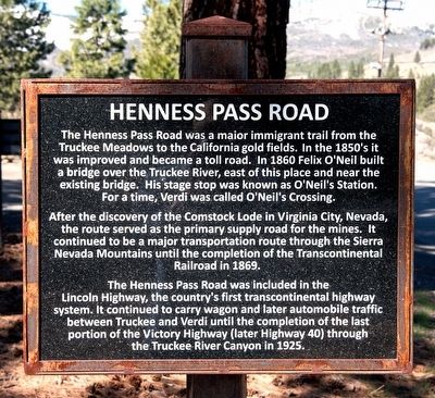
Henness Pass Road
After the discovery of the Comstock Lode in Virginia City, Nevada, the route served as the primary supply road for the mines. It continued to be a major transportation route through the Sierra Nevada Mountains until the completion of the Transcontinental Railroad in 1869.
The Henness Pass Road was included in the Lincoln Highway, the country's first transcontinental highway system. It continued to carry wagon and later automobile traffic between Truckee and Verdi until the completion of the last portion of the Victory Highway (later Highway 40) through the Truckee River Canyon in 1925.
Topics and series. This historical marker is listed in these topic lists: Roads & Vehicles • Settlements & Settlers. In addition, it is included in the Henness Pass, and the Lincoln Highway series lists. A significant historical year for this entry is 1860.
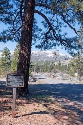
Location. 39° 31.475′ N, 120° 0.122′ W. Marker is in Verdi, Nevada , in Washoe County. Marker is on Henness Pass Road, on the left when traveling west. Marker is located in Von Schmidt Monument Historic Park at the Nevada-California border. Although the park is actually on the California side of the border, the park is just outside the town of Verdi, Nevada. Touch for map. Marker is in this post office area: Verdi NV 89439, United States of America. Touch for directions.
Other nearby markers. At least 8 other markers are within walking distance of this marker. Von Schmidt (here, next to this marker); Truckee/Donner Trail (here, next to this marker); Overview (here, next to this marker); The Town of Crystal Peak (here, next to this marker); Verdi Veterans Memorial (approx. 0.2 miles away); Crystal Peak Toll Bridge (approx. 0.4 miles away); Truckee Trail - Rocky Ravine (approx. 0.6 miles away in California); Verdi (approx. ¾ mile away). Touch for a list and map of all markers in Verdi.
Also see . . . Henness Pass Road. A short description of a 4-wheel drive driving tour of the Henness Pass Road - California Historical Landmark #421 (Submitted on May 1, 2016.)
Credits. This page was last revised on June 16, 2016. It was originally submitted on April 28, 2016, by Alvis Hendley of San Francisco, California. This page has been viewed 601 times since then and 36 times this year. Photos: 1, 2. submitted on April 28, 2016, by Alvis Hendley of San Francisco, California. • Syd Whittle was the editor who published this page.

