Verdi in Washoe County, Nevada — The American Mountains (Southwest)
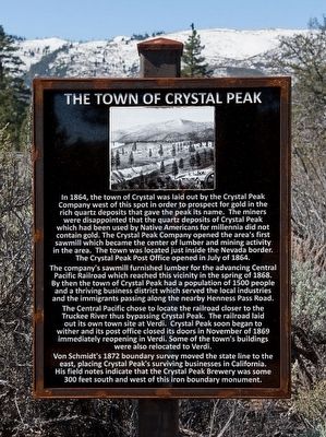
The Town of Crystal Peak
The company's sawmill furnished lumber for the advancing Central Pacific Railroad which reached this vicinity in the spring of 1868. By then the town of Crystal Peak had a population of 1500 people and a thriving business district which served the local industries and the immigrants passing along the nearby Henness Pass Road.
The Central Pacific chose to locate the railroad closer to the Truckee River thus bypassing Crystal Peak. The railroad laid out its own town site at Verdi. Crystal Peak soon began to wither and its post office closed its doors in November of 1869 immediately reopening in Verdi. Some of the town's buildings were also relocated to Verdi.
Von Schmidt's's 1872 boundary survey moved the state line to the east, placing Crystal Peak's surviving business in California. His field notes indicate that the Crystal Peak Brewery was some 300 feet south and west of this iron boundary marker.
Topics. This historical marker is listed in these topic lists: Industry & Commerce • Railroads & Streetcars. A significant historical year for this entry is 1864.
Location. 39° 31.475′ N, 120° 0.122′ W. Marker is in Verdi, Nevada, in Washoe County. Marker is on Henness Pass Road, on the left when traveling west. Marker is located in Von Schmidt Monument Historic Park at the Nevada-California border. Although the park is actually on the California side of the border, the park is just outside the town of Verdi, Nevada. Touch for map. Marker is in this post office area: Verdi NV 89439, United States of America. Touch for directions.
Other nearby markers. At least 8 other markers are within walking distance of this marker. Von Schmidt (here, next to this marker); Henness Pass Road (here, next to this marker); Truckee/Donner Trail (here, next to this marker); Overview (here, next to this marker); Verdi Veterans Memorial (approx. 0.2 miles away); Crystal Peak Toll Bridge (approx. 0.4 miles away); Truckee Trail - Rocky Ravine (approx. 0.6 miles away in California); Verdi (approx. ¾ mile away). Touch for a list and map of all markers in Verdi.
Credits. This page was last revised on June 16, 2016. It was originally submitted on April 28, 2016, by Alvis Hendley of San Francisco, California. This page has been viewed 618 times since then and 51 times this year. Photo 1. submitted on April 28, 2016, by Alvis Hendley of San Francisco, California. • Syd Whittle was the editor who published this page.
Editor’s want-list for this marker. A wide shot of the marker and its surroundings. • Can you help?
