Laupahoehoe in Hawaii County, Hawaii — Hawaiian Island Archipelago (Pacific Ocean)
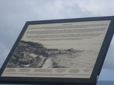
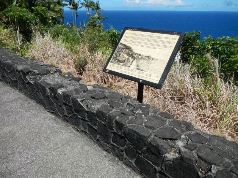
Laupahoehoe Point
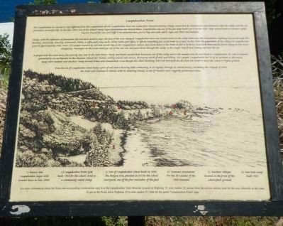
Slowly, with the influence of plantation life and more modern ways, the face of the area changed. Laupahoehoe town was located down in the valley where the old Mamalahoa Highway led you through this thriving community. Boasting restaurants, hotels, a coffee mill, soda works, livery stables, post office, it offers everything you could want in a town. In the 1920s the population of the village in Laupahoehoe grew to approximately 2,000. From 1912 people traveled by rail and would stop at the Laupahoehoe station and travel down to the Point on foot or by horse. Even back then tourists found refuge in this area's tranquility. Passengers on the train could get out of the rail cars and grace down through the valley, to the rough "leaf of lava" jutting out into the sea.
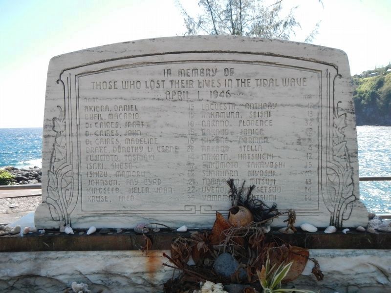
As people took the train more, less activity was seen in the town below. Slowly merchants moved their businesses out of the valley and to the mauka area we now know as Laupahoehoe. In 1946, a tsunami generated by an earthquake in the Aleutian Islands hit Hawaii, ending coastal rail services, destroying much of Hilo and killing 150+ people. Laupahoehoe lost 24 of its residents to the waves; many were students and teachers. Many private homes were demolished. Even though the school buildings were not destroyed the decision was made to move the school to higher ground.
From the era of Laupahoehoe Point being port of call and a thriving little community in its heyday, through it varied history, including the Tragedy of 1946, the point will continue to attract, with its enduring beauty, as one of Hawaii's most ruggedly picturesque areas.
Topics and series. This historical marker is listed in these topic lists: Disasters • Industry & Commerce • Settlements & Settlers. In addition, it is included in the Lost at Sea series list. A significant historical date for this entry is April 1, 1946.
Location. 19° 59.12′ N, 155° 14.165′ W. Marker is in Laupahoehoe, Hawaii, in Hawaii County. Marker is on Highway 19 (Hawaii Route 19), on the right when traveling north. Touch for map. Marker is in this post office area: Laupahoehoe HI 96764, United States of America. Touch for directions.
Other nearby markers. At least 4 other markers are within 16 miles of this marker
Photographed By Barry Swackhamer, September 1, 2017
2. Laupahoehoe Point Marker
Captions: 1) Branco Side Laupahoehoe Sugar Mill located there in late 1800s.; 2) Laupahoehoe Point Gym built 1939 for the school. Used as a community center.; 3) Site of Laupahoe School built in 1883. The banyan tree planted in 1917 in the school courtyard, one of the few reminders of the past.; 4) Tsumani Monument For 24 victims of the 1946 tsunami.; 5) Teachers cottages located in the front of the school/park grounds.; 6) New boat ramp built 1987.
Photographed By Barry Swackhamer, September 1, 2017
5. Memorial at Laupahoehoe
Those Who Lost Their Lives in the Tidal Wave
April 1, 1946
Photographed By Barry Swackhamer, September 6, 2017
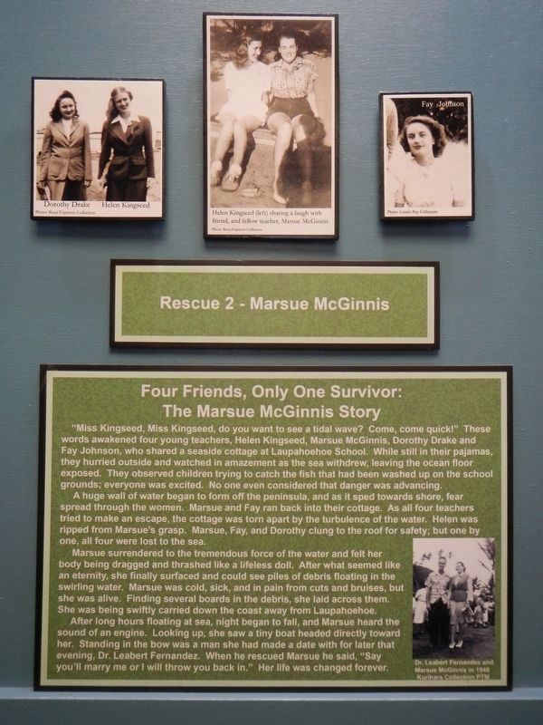
6. For Friends, Only One Survivor: The Marsue McGinnis Story
"Miss Kingseed, Miss Kingseed, do you want to see a tidal wave? Come, come quick!" These words awakened four young teachers, Helen Kingseed, Marsue McGinnis, Dorothy Drake, and Fay Johnson, who shared a seaside cottage at Laupahoehoe School. While still in their pajamas, they hurried outside and watched in amazement as the sea withdrew, leaving the ocean floor exposed. They observed children trying to catch the fish that had been washed up on the school grounds; everyone was excited. No one even considered that the danger was advancing.
A huge wall of water began to form off the peninsula, and as it sped towards shore, fear spread through the women. Marsue and Fay ran back into their cottage. As all four teachers tried to make an escape, the cottage was torn apart by the turbulence of the water. Helen was ripped from Marsue's grasp. Marsue, Fay, and Dorothy clung to the roof for safety, but one by one, all four were lost to the sea.
Marsue surrendered to the tremendous force of the water and felt her body being dragged and thrashed like a lifeless doll. What seemed like an eternity, she finally surfaced and could see piles of debris floating in the swirling water. Mars was cold, sick, and in pain from the cuts and bruisesFinding several boards of debris, she laid across them. She was being swiftly carried down the coast away from Laupahoehoe.
After long hours floating at sea, night began to fall, and Marsue heard the sound of an engine. Looking up she saw a tiny boat heading directly toward her. Standing at the bow was a man she had made a date with for later that evening, Dr. Leabert Fernandez. When he rescued Marsue he said, "Say you'll marry me of I will throw you back in." Her life was changed forever. -- (Exhibit at the Tsunami Museum at Hilo, Hawaii)
Credits. This page was last revised on December 2, 2017. It was originally submitted on April 29, 2016, by Adam Margolis of Mission Viejo, California. This page has been viewed 996 times since then and 130 times this year. Photos: 1. submitted on April 29, 2016, by Adam Margolis of Mission Viejo, California. 2. submitted on November 30, 2017, by Barry Swackhamer of Brentwood, California. 3. submitted on April 29, 2016, by Adam Margolis of Mission Viejo, California. 4. submitted on November 30, 2017, by Barry Swackhamer of Brentwood, California. 5, 6. submitted on December 2, 2017, by Barry Swackhamer of Brentwood, California. • Syd Whittle was the editor who published this page.
