Chance, Saint John, Dominica — Caribbean Region of the Americas (Lesser Antilles of the West Indies)
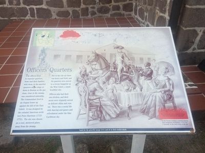
Officers' Quarters
The officers lived in separate quarters. Some had their families with them, in the married quarters on the slope or down in Roseau as the garrison, close to the swamp, was considered unhealthy. The Commandant live in an elegant house up against the hill of the East Cabrit. It was designed by the colonial American architect Peter Harrison (1713-1773). The site was chosen as a cool, sheltered place, away from the swamp.
But in fact the air there was heavy and fetid, and his quarters were moved to a breezy bungalow on the West Cabrit, a much healthier site.
Officers also had their own kitchen, and their meals were elegantly served on delicate china and crystal. There was a social life with dancing and games and refreshment under the blue Caribbean sky.
True. Rainfall in Dominica varies from 30 inches on the coast to 300 inches in the central mountainous areas.
The Cabrits were once a separate island. How was it joined to the mainland?
· By the French, building a causeway during their occupation of Dominica, 1778-1783
· Naturally, by the tidal action of the sea Look for the graceful mango trees and site in their restful shade.
Topics. This historical marker is listed in these topic lists: Colonial Era • Forts and Castles.
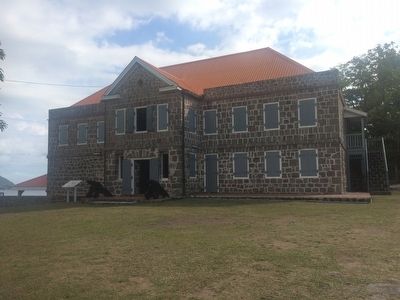
Location. 15° 34.991′ N, 61° 28.418′ W. Marker is in Chance, Saint John. Marker can be reached from Bay Street. The marker is directly in front of the Officers' Quarters at Fort Shirley. Touch for map. Touch for directions.
Other nearby markers. At least 8 other markers are within walking distance of this marker. Upper Battery, Signal Station (a few steps from this marker); Cabrits Calendar of Events (within shouting distance of this marker); Guard House, Powder Magazine (within shouting distance of this marker); Water Catchment, Troops' Kitchen, Stables (within shouting distance of this marker); Fort Shirley (within shouting distance of this marker); The Trees Return (about 90 meters away, measured in a direct line); Prince Rupert's Garrison (about 150 meters away); Cabrits National Park (about 180 meters away). Touch for a list and map of all markers in Chance.

Photographed By J. Makali Bruton, April 15, 2016
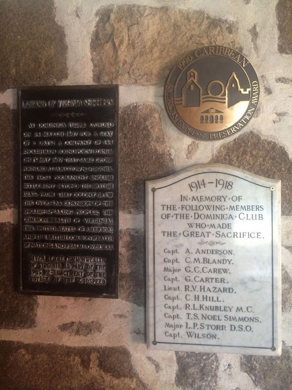
4. Interior markers, including Landing of Virginia Settlers
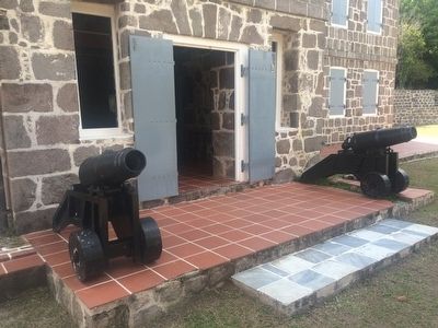
Three markers are located on the right in the entryway of the reconstructed Officers's Quarters.
Landing of Virginia Settlers
At Dominica there landed on 24 March 1607 for a stay of 2 days: a company of 144 Englishmen bound for Virginia. On 13 May 1607 that same group founded at Jamestown, Virginia, the first permanent English settlement beyond the British Isles. From that colony grew the overseas expansion of the English-speaking people; the Commonwealth of Virginia; The United States of America; and the British Commonwealth of Nations and realms overseas.
Given by the Commonwealth of Virginia as part of the 1985 re-enactment of the voyage of the Godspeed
1990 Caribbean American Express Preservation Award
1914-1918
In memory of the following members of the Dominica Club who made the Great Sacifice
Fallen officers named also on World Wars Memorial in Roseau
1990 Caribbean American Express Preservation Award
In memory of the following members of the Dominica Club who made the Great Sacifice
Fallen officers named also on World Wars Memorial in Roseau
Credits. This page was last revised on March 18, 2017. It was originally submitted on May 7, 2016, by J. Makali Bruton of Accra, Ghana. This page has been viewed 284 times since then and 10 times this year. Photos: 1, 2, 3, 4. submitted on May 7, 2016, by J. Makali Bruton of Accra, Ghana.


