Near Newnan in Coweta County, Georgia — The American South (South Atlantic)
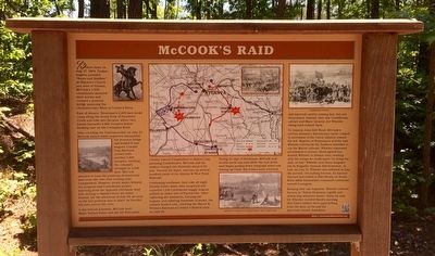
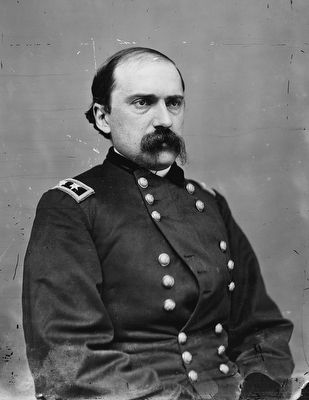
McCook's Raid
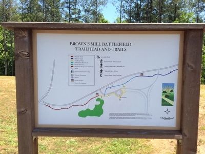
Brown's Mill Battlefield
Before dawn on July 27, 1864, Yankee buglers sounded "Boots and Saddles." At Mayson's Church just west of Atlanta, McCook's 1,600 cavalrymen mounted their horses and crossed a pontoon bridge spanning the Chattahoochee River at Turner's Ferry.
East of Atlanta, Stoneman's 2,200 men broke camp along the South Fork of Peachtree Creek and rode into Decatur, where they joined Garrard's 4,000 troopers before heading east on the Covington Road.
After crossing the Chattahoochee on July 27, McCook waited while engineers dismantled the pontoon bridge and loaded it into wagons. Colonel Tom Harrison arrived with another 1,400 troopers, swelling the column's strength to 3,000 men. McCook planned to haul the pontoons downstream and cross the river that evening near Campbellton. However, weary mules delayed his progress and Confederate pickets watching from the opposite riverbank, kept him moving to Smith's Ferry six miles beyond. On the afternoon of July 28, as soon as the last pontoon was in place, he hurried his men across the river.
A day behind schedule, McCook sent Major Nathan Paine and the 1st Wisconsin Cavalry toward Campbellton to distract any pursuing Confederates. McCook and his raiders charged into Palmetto about 6:00 p.m., burned the depot, and tore up several hundred yards of the Atlanta & West Point Railroad.
Continuing southeast, they rode all night. Shortly before dawn, they surprised and captured 1,100 Confederate supply wagons parked on either side of Fayetteville. After capturing the teamsters, burning the wagons, and sabering hundreds of mules, the column headed east, reaching the Macon & Western Railroad at Lovejoy's Station early on July 29.
Seeing no sign of Stoneman, McCook sent scouts north and east while the rest of his men began pulling down telegraph wires and tearing up track. His scouts soon returned and reported cavalry coming fast, but not Stoneman's. Instead, they saw Confederate cavalry and Major General Joe Wheeler riding hard toward them.
To General John Bell Hood, McCook's activity seemed a diversionary tactic related to movement of the Union infantry toward his left. Reports of Stoneman's activity had Wheeler convinced the Yankees intended to cut the Macon railroad. Wheeler requested permission to pursue. Hood agreed but wanted Wheeler to remain near, sending only the troops he could spare "to bring the raid... to bay." Wheeler sent three brigades led by Brigadier General Alfred Iverson, Jr. Late on July 27, Wheeler was released to join the pursuit. Overtaking Iverson, he learned Garrard had halted at Flat Shoals on South River while Stoneman's command continued toward Covington.
Keeping only one
regiment, Wheeler ordered Iverson to "follow Stoneman rapidly and attack him wherever found." Early on July 29, Wheeler received Hood's warning that Union raiders were approaching from the west, so he and his men rode toward Jonesboro.
Erected 2013 by Coweta County, Georgia Departments of Transportation & Natural Resources.
Topics. This historical marker is listed in this topic list: War, US Civil. A significant historical date for this entry is July 27, 1864.
Location. 33° 20.092′ N, 84° 50.348′ W. Marker is near Newnan, Georgia, in Coweta County. Marker can be reached from Millard Farmer Road, 0.4 miles east of Old Corinth Road, on the right when traveling east. Touch for map. Marker is at or near this postal address: 155 Millard Farmer Road, Newnan GA 30263, United States of America. Touch for directions.
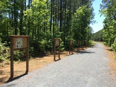
Other nearby markers. At least 8 other markers are within 4 miles of this marker, measured as the crow flies. "The Big Raid" (here, next to this marker); Wheeler's Pursuit (a few steps from this marker); The Battle of Brown's Mill: Detour to Battle (a few steps from this marker); The Battle of Brown's Mill: Ride for the River (a few steps from this marker); The Battle of Brown's Mill: Aftermath (a few steps from this marker); Gen. Jos. Wheeler, C.S.A. (approx. 0.3 miles away); In Memoriam (approx. 0.3 miles away); William McIntosh (approx. 3˝ miles away). Touch for a list and map of all markers in Newnan.
Related markers. Click here for a list of markers that are related to this marker. To better understand the relationship, study each marker in the order shown.
Credits. This page was last revised on June 3, 2020. It was originally submitted on May 16, 2016, by Mark Hilton of Montgomery, Alabama. This page has been viewed 745 times since then and 49 times this year. Photos: 1, 2, 3, 4, 5. submitted on May 16, 2016, by Mark Hilton of Montgomery, Alabama.
