Marble Canyon in Coconino County, Arizona — The American Mountains (Southwest)
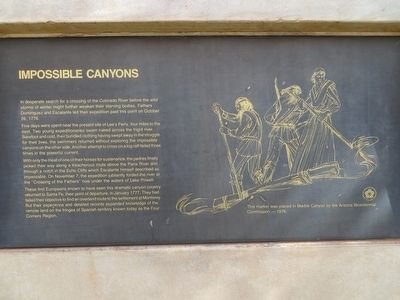
Impossible Canyons
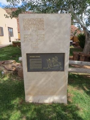
Dominguez y Escalante Expedition 1776-1976
Five days were spent near the present site of Lee's Ferry, four miles to the east. Two young expeditionaries swam naked across the frigid river. Barefoot and cold, their bundled clothing having swept away in the struggle for their lives, the swimmers returned without exploring the impossible canyons on the other side. Another attempt to cross on a log raft failed three times in the powerful current.
With only the meat of one of their horses for sustenance, the padres finally picked their way along a treacherous route above the Paria River and through a notch in the Echo Cliffs which Escalante himself described as impassable. On November 7, the expedition jubilantly forded the river at the "Crossing of the Fathers" now under the waters of Lake Powell.
These first Europeans known to have seen this dramatic canyon country returned to Santa Fe, their point of departure, in January 1777. They had failed their objective to find and overland route to the settlement at Monterey. But their experience and detailed records expanded knowledge of the remote land on the fringes of Spanish territory known today as the Four Corners Region.
Erected 1976 by Arizona Bicentennial Commission.
Topics and series. This historical marker is listed in this topic list: Exploration. In addition, it is included in the Dominguez y Escalante Expedition, and the The Spirit of ’76, America’s Bicentennial Celebration series lists. A significant historical month for this entry is January 1777.
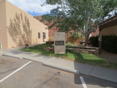
Location. 36° 48.986′ N, 111° 38.347′ W. Marker is in Marble Canyon, Arizona, in Coconino County. Marker is on U.S. 89A at milepost 538.3, on the right when traveling west. Marker is between the post office and a gas station, on the north side of hwy 89A. Touch for map. Marker is in this post office area: Marble Canyon AZ 86036, United States of America. Touch for directions.
Other nearby markers. At least 8 other markers are within walking distance of this marker. Lee Ferry (about 400 feet away, measured in a direct line); Marble Canyon Lodge (approx. 0.3 miles away); Lee's Ferry (approx. 0.3 miles away); Lafe McDaniel (approx. 0.4 miles away); Navajo Bridge (approx. 0.4 miles away); John Deering (approx. half a mile away); Lewis Nez (approx. half a mile away); a different marker also named Navajo Bridge (approx. half a mile away). Touch for a list and map of all markers in Marble Canyon.
More about this marker. Google street view from June 2008 shows this marker on the south side of hwy 89A.
Also see . . .
1. Domínguez–Escalante Expedition on Wikipedia. (Submitted on December 2, 2019.)
2. Article from Intermountain Histories. (Submitted on December 2, 2019.)
Credits. This page was last revised on December 2, 2019. It was originally submitted on May 26, 2016, by Bill Kirchner of Tucson, Arizona. This page has been viewed 556 times since then and 14 times this year. Photos: 1, 2, 3. submitted on May 26, 2016, by Bill Kirchner of Tucson, Arizona.


