Bluff in San Juan County, Utah — The American Mountains (Southwest)
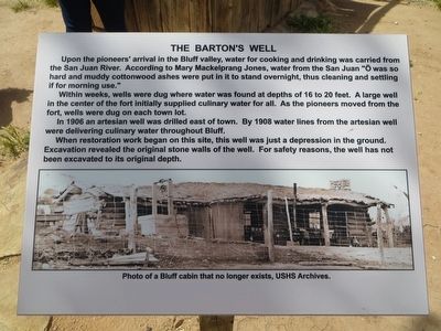
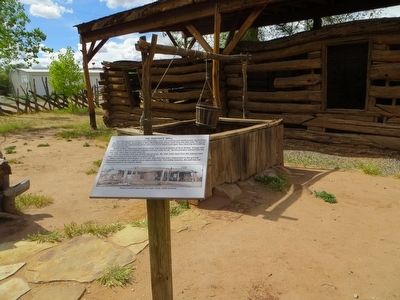
The Barton's Well
Within weeks, wells were dug where water was found at depths of 16 to 20 feet. A large well in he center of the fort initially supplied culinary water for all. As the pioneers moved from the fort, wells were dug on each town lot.
In 1906 an artesian well was drilled east of town. By 1908 water lines from the artesian well were delivering culinary water throughout Bluff.
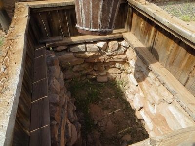
When restoration work began on this site, this well was just a depression in the ground. Excavation revealed the original stone walls of the well. For safety reasons, the well has not been excavated to its original depth.
Topics. This historical marker is listed in these topic lists: Forts and Castles • Settlements & Settlers. A significant historical year for this entry is 1880.
Location. 37° 17.01′ N, 109° 33.198′ W. Marker is in Bluff, Utah, in San Juan County. Marker is on the grounds of the Bluff Fort Historic Site. Touch for map. Marker is at or near this postal address: 550 East Black Locust Avenue, Bluff UT 84512, United States of America. Touch for directions.
Other nearby markers. At least 8 other markers are within walking distance of this marker. Amasa Barton's Blacksmith Shop (within shouting distance of this marker); Parley R. & Ency Camilla (Bayles) Butt (within shouting distance of this marker); Kumen Jones Home (within shouting distance of this marker); Josephine Catherine Chatterley Wood (within shouting distance of this marker); The Co-op Store (within shouting distance of this marker); Site of Kumen Jones Home (about 300 feet away, measured in a direct line); Replica of the Bluff Meetinghouse (about 300 feet away); Jens House (about 600 feet away). Touch for a list and map of all markers in Bluff.
Credits. This page was last revised on June 16, 2016. It was originally submitted on June 4, 2016, by Bill Kirchner of Tucson, Arizona. This page has been viewed 375 times since then and 8 times this year. Photos: 1, 2, 3. submitted on June 4, 2016, by Bill Kirchner of Tucson, Arizona.


